

Published May 10, 2026 03:03AM
“I don’t know about you,” said the cowboy in his booming Wyoming voice. “But when I follow these old trails, I can just see the wagons coming up over the hill.”
My wife and I were chatting with this friendly old-timer at a multi-use trailhead, out where the sagebrush desert meets the Rocky Mountains. We were clad in hiking clothes, while our new acquaintance was decked out like John Wayne. He stared at the horizon, imagining oxen-pulled wagon trains sending up dust. We stood there awkwardly and sipped from insulated water bottles.
It was a sunny morning on our summer road trip along the historic Oregon Trail (OT). The idea to follow this real-life National Park Service (NPS) route had been growing for years, partly planted in grade school, when I played The Oregon Trail computer game in a raucous classroom filled with shrieking kids and busted PCs. It was a giggling miracle when anyone made it to Oregon, given most of us were focused on the next recess.
My wife didn’t share that nostalgic experience because she grew up in Germany before moving to the U.S. in her twenties. Together, we developed a fondness for a hybrid kind of road trip, mixing outdoor adventures with history and quirky Americana. We’ve had great success doing this over the years, from national park mysteries to forgotten space trails to Route 66. Our main outdoorsy mod is that we don’t obsess over hitting every stop. Instead, we seek out wide-open landscapes, surprising experiences, and fascinating stories from our nation’s turbulent past.
During the summer of 2025, we were pleased to find all these things along the 2,170-mile OT. Plus, we witnessed an ongoing movement to reinterpret trail history, shifting away from glorified tales of triumphant pioneers settling an untamed wilderness to a more honest appraisal that considers the effects of emigration on Native people of the West.
Oh, and ruts. We also encountered a ton of wagon ruts. Way more ruts, frankly, than we ever wanted to see.
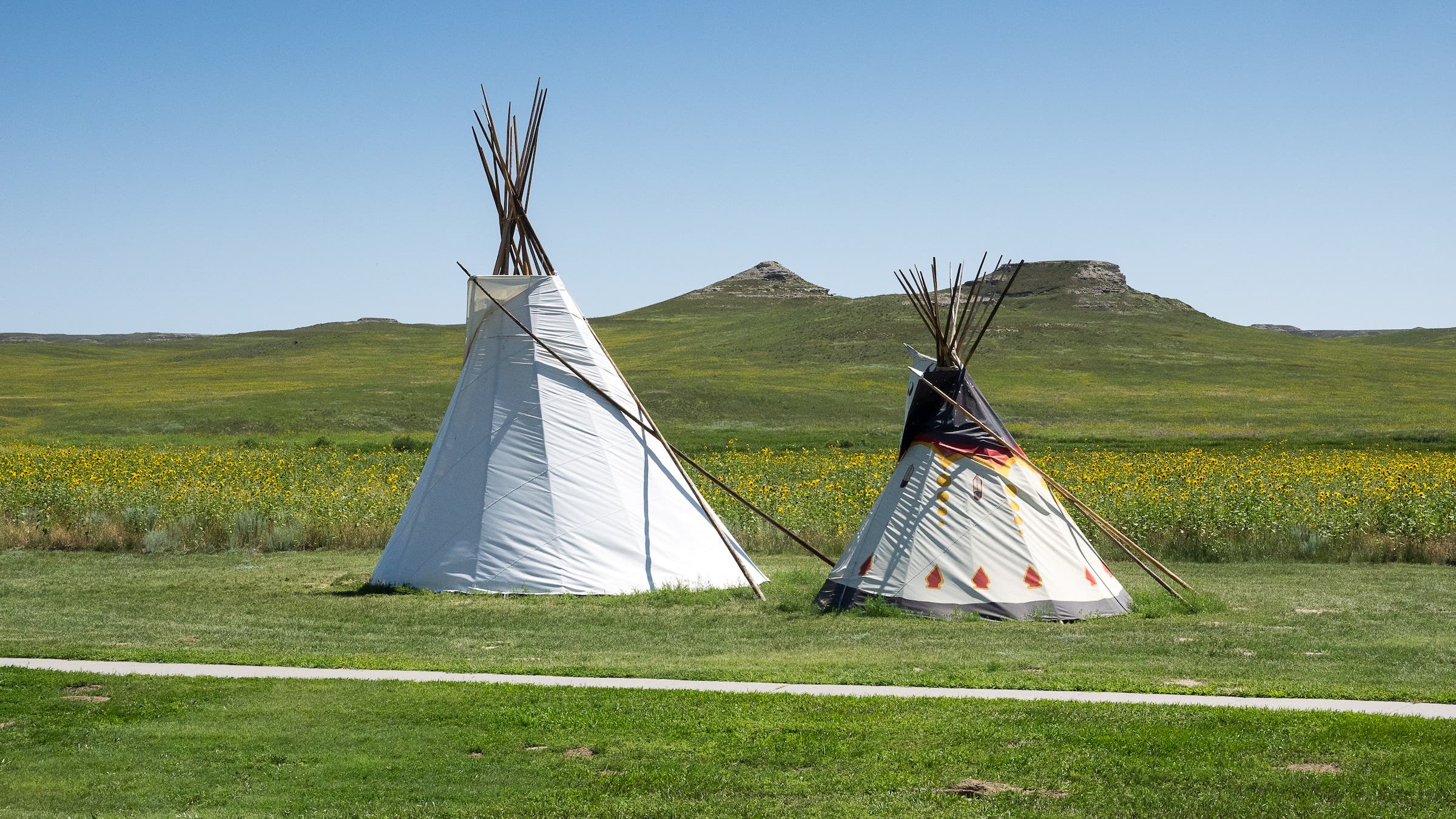
Treeless Plains of Western Nebraska
Dark clouds swirled as we walked prairie trails at Homestead National Historical Park in Southeastern Nebraska. Nearby, the modern Heritage Center rose sharply with a roofline resembling a farm plow. This remote NPS unit commemorates a big reason emigrants went west: 1800s homesteading laws that encouraged primarily white Americans to secure the region from Indigenous tribes and British fur companies.
Contrary to what the computer game suggested, there were very few “adventurous bankers” among these pre-railroad settlers. The vast majority were farming families and tradespeople from the Midwest and South. Most came in steamboats up the Missouri River before purchasing wagons, oxen, and supplies in trail towns like Independence. Today, it’s a suburb of Kansas City, where history buffs start with museum visits.
Outdoorsy travelers may prefer starting on the Great Plains, where the serene landscape still resembles the old days. For this reason, we skipped ahead on I-80 toward Western Nebraska, turning onto US-26 where the OT veers northwest along the North Platte River.
Most emigrants were unprepared for this increasingly arid region. Except for the wooded river bottoms, the tallgrass plains were devoid of trees. However, bison herds were an abundant resource, both for hunting and for their droppings, aka “buffalo chips,” which were burned for cooking fires.
Another challenge was finding palatable drinking water. With the river being so silty, wagon trains congregated at sporadic creeks and springs, which became contaminated by fecal bacteria. Between the mid-1840s and late-1860s, an estimated 400,000 emigrants followed the OT west. Around 25,000 of them died en route, mostly from cholera and dysentery on the Great Plains.
Our next stop was Ash Hollow State Historical Park. After hiking some blufftop trails, we followed a steep path up Windlass Hill. When retracing the OT today, be prepared for a lot of comments about one thing.
“Have you seen the ruts?”
“Leave time for ruts.”
“Sure do love them ruts, sumthin’ awful.”
“I like big ruts and I cannot lie.”
Here’s the thing. At first, very few emigrants went west, and Natives helped the struggling travelers. As emigration increased exponentially, wagon trains spread out in search of dwindling resources. During its heyday, the OT wasn’t a single trail but a series of expanding corridors many miles wide. Regional tribes were increasingly strained by this growing invasion, and violent conflicts were inevitable. Signs of this struggle can be seen across the West in the lingering scars of wagon ruts.
At Windlass Hill, countless ruts spill over high tablelands from all directions, chaotically funneling into a narrow valley leading straight to the once-overtaxed spring at Ash Hollow. Knowing such backstories makes each OT landmark more revealing. While the wary pioneers fixated on the rare attacks by Native people, the real race was against hunger, thirst, disease, and shifting seasons.
You can contemplate this on hiking trails at many subsequent sites, including three in Western Nebraska. Chimney Rock is a national historic site run by the state (checks out). At Scottsbluff National Monument, the signature bluff rises 800 feet above a quaint river town, home to tasty Flyover Brewing. And Agate Fossil Beds National Monument is an hour north across the treeless plains, with paleontological hikes and a museum with Lakota artifacts.
Wyoming Rockies and Red Desert
We were hiking through riverside woodlands at Fort Laramie National Historical Site in Southeast Wyoming. This little-visited park, with free admission, like most NPS units along the OT, punches above its weight with trails, ruins, and historical buildings to explore. Speaking of weight, some emigrants called this stop Camp Sacrifice. During the four to six weeks spent getting here, many OT travelers discovered their wagons were grossly overloaded. As a result, the trails across the Plains became littered with furniture, stoves, anvils, and even pianos. Whatever luxuries remained were often jettisoned at this U.S. Army outpost and resupply depot.
Continuing through foothills, today’s travelers often stop at Ayres Natural Bridge Park. Next, the small city of Casper has a fun brewpub scene and the National Historic Trails Interpretive Center, a top-notch free museum and Bureau of Land Management (BLM) visitor center. Further west, scramble around granite landmarks like Independence Rock, Devil’s Gate, and Split Rock.
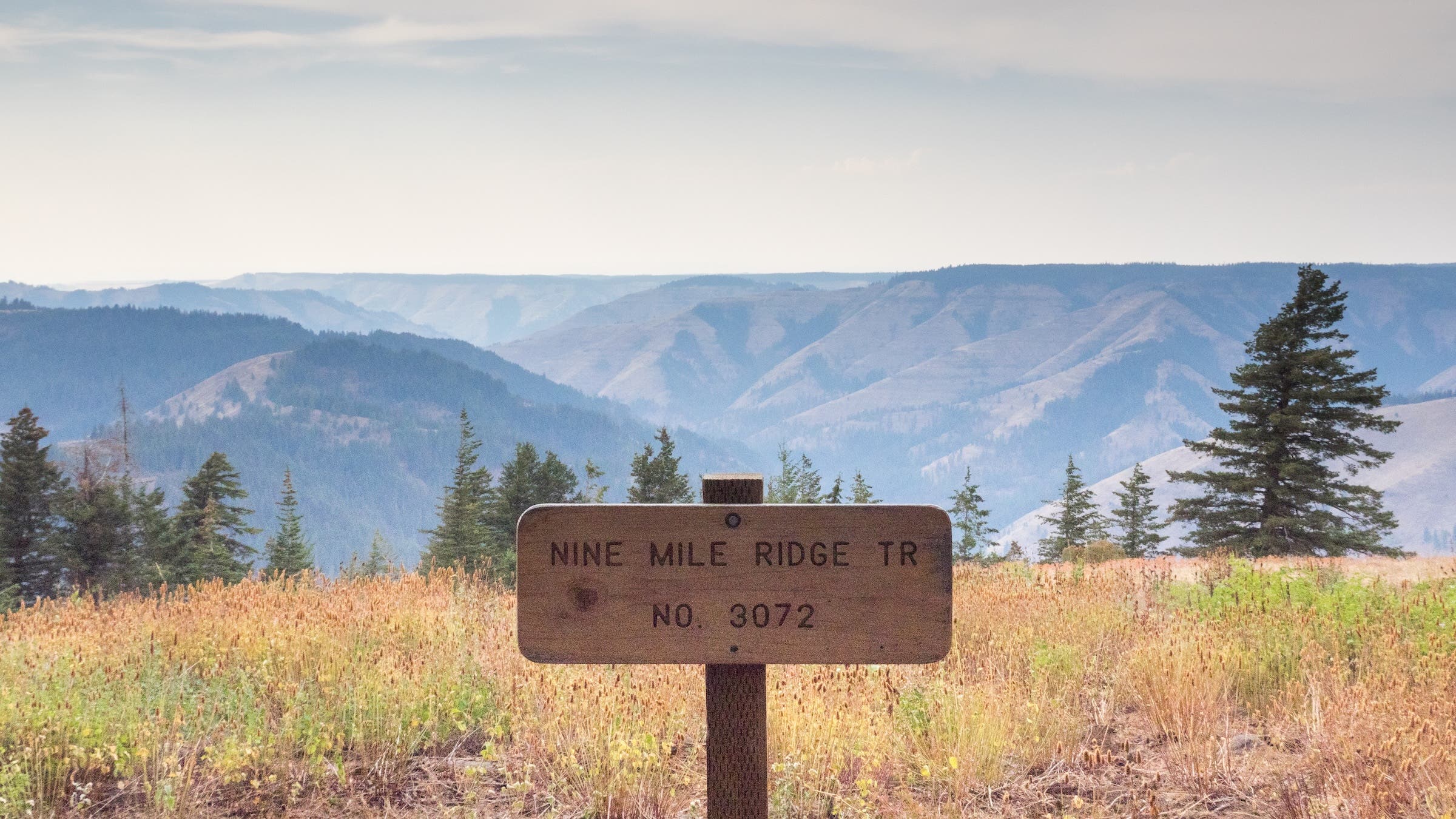
Some of the best adventures along the OT are found around the Wind River Range. Definitely stop by the outdoor town of Lander. For cyclists, the friendly folks at the Bike Mill offer rentals and info about singletrack, like Johnny Behind the Rocks, or gravel sections of the Great Divide MTB Route, including a ridiculously scenic ride along a foothills spur of the OT, the rolling Lander Cutoff Road.
Emigrants avoided the jagged Winds for the same reason that, today, they’re an outdoorsy playground—especially for hikers, climbers, and backpackers. Above town, Sinks Canyon is named for a section of the Middle Popo Agie River (locally pronounced “puh-poh-zhuh”) that vanishes underground and reappears at the Rise. Nearby, a gradual 1.5-mile trail leads to Popo Agie Falls.
To reach rougher terrain, drive the Fossil Hill switchbacks to the trailhead at Worthen Meadow Reservoir. One great backpacking option is an overnight into the alpine around Stough Creek Lakes, which can be combined with other trails to create longer trips. With that under your hip belt, head to the western Winds for a section hike on the long-distance Continental Divide Trail. (Note this is bear country, mostly black but a rare grizz is possible, so be prepared.)
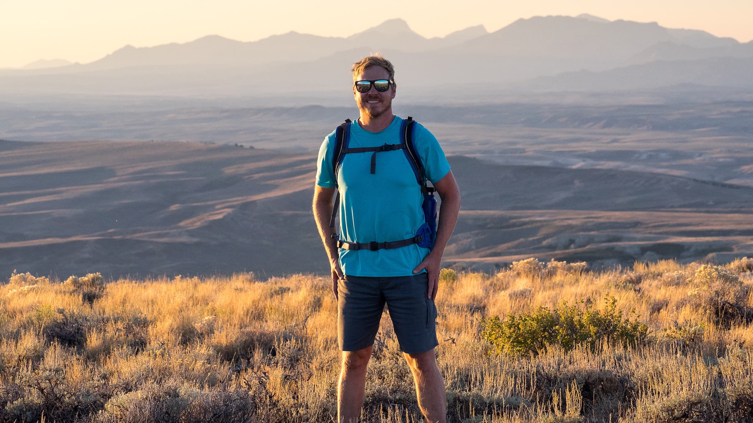
Speaking of the divide, emigrants used the gradual crossing at South Pass. Located in the Red Desert, today the region is an overlander’s dream with rugged 4×4 tracks leading to buttes, dune fields, and ancestral petroglyphs. Maintained gravel roads access ghost towns like the ruins of Miner’s Delight, the still-lived-in Atlantic City, and the restored South Pass City State Historic Site.
Further adventures abound throughout Wyoming, and outdoor travelers could easily skip my next stop and divert to Jackson Hole or Yellowstone. Unfortunately, my wife could not continue onward. This wasn’t the typical lost spouse from the OT days or anything. She had to fly home for work, which is nearly as bad.
Continuing solo, I finally visited Fort Bridger State Historic Site after passing by for years. Established by mountain man Jim Bridger in 1842, this fur trade outpost became an OT supply stop. Today it’s an interesting park-like museum. At the replica log fort, an interpretive ranger in a pioneer dress offered an impromptu tour. Eventually, we discussed the earliest OT travelers, including missionaries Marcus and Narcissa Whitman in 1836.
“She told him she’d only marry him if he could get a wagon across to the West,” said the ranger, putting a romantic spin on an infamous OT tale that takes a morbid turn further west. “I guess he really wanted to marry Narcissa.”
Craters of the Moon and Snake River Plain, Idaho
For a moment, the underground trail went dark. As my eyes adjusted, I resumed scrambling toward a distant opening. I’d entered the darkest chamber of Indian Tunnel, a partly intact lava tube at Craters of the Moon National Monument and Preserve in Idaho.
In 1862, growing tensions on the main OT, 60 miles south of here, led to a fight that killed several dozen Natives and emigrants. The skirmish site received a wide berth and a sensational name, known today as Massacre Rocks State Park. Many wagons began diverting onto the Goodale Cutoff, which followed an Indigenous route along the northern edge of a tortuous lava field.
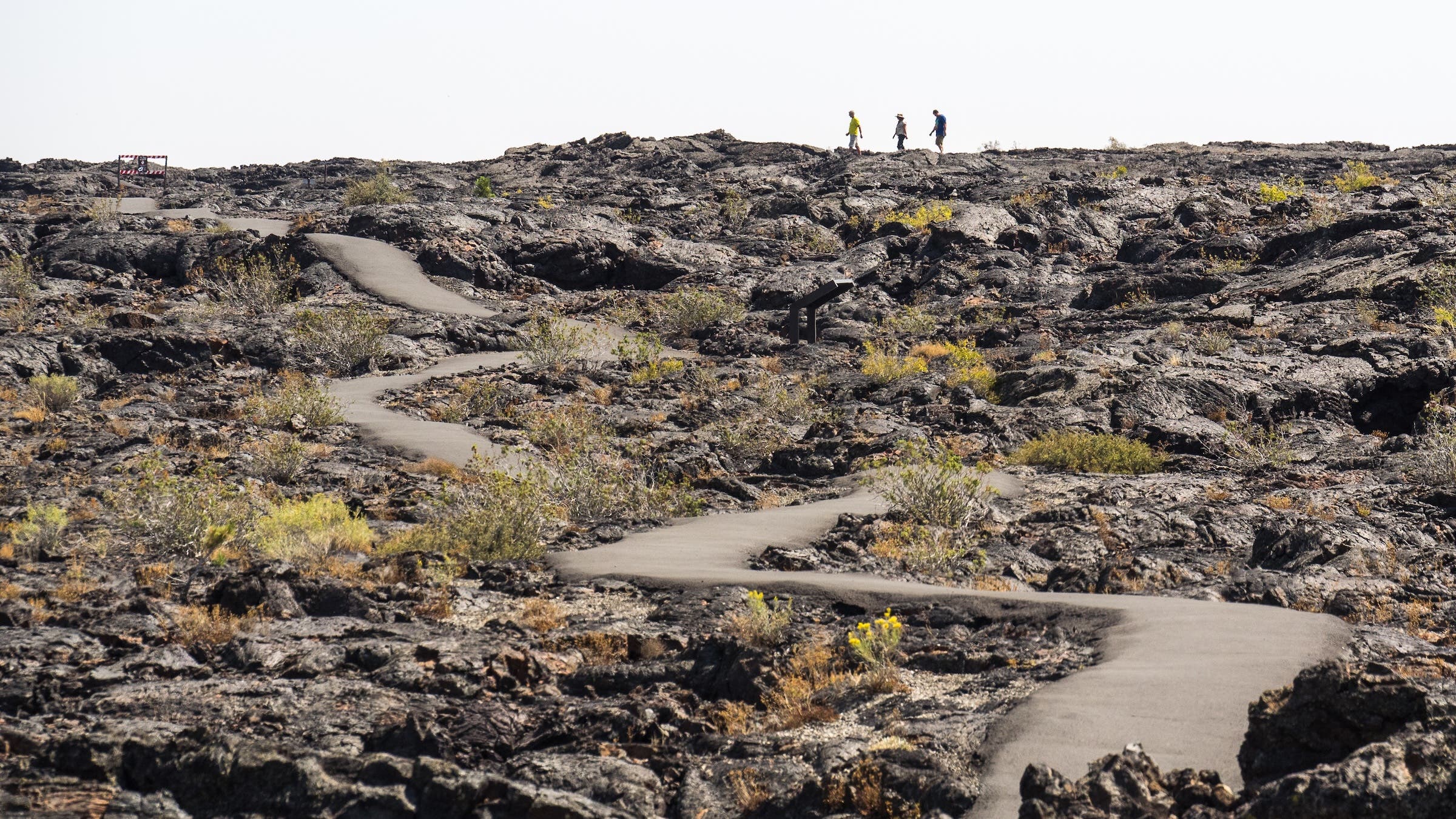
Today, Craters of the Moon is an impressive NPS unit spanning about 1,175 square miles, a size comparable to Yosemite. Due to the preserve’s remote location, it sees a fraction of the visitors at major national parks. The result is a quiet hiker’s destination with trails winding through volcanic cones and craters. Most of the preserve is rugged wilderness, perfect for day hikes or desert backpacking. Among the unique features are tree molds, where ancient lava flows cooled around trunks before they burned away.
The entire Snake River Plain is a vast volcanic formation, created by the relative movements of North America over the same hotspot powering the geysers of Yellowstone to the northeast. Most emigrants needed nearly a month to cross this rugged basalt landscape. Today’s interstate travelers often speed through on their way to the surrounding mountains, but there are reasons to linger.
Pocatello is a college town, named for a celebrated Northern Shoshone leader, with an expanding hiking and biking scene and a fun gathering spot at Jim Dandy Brewing. Boise is a booming river city of new transplants who learn from earlier transplants that it’s not “Boy-zee,” it’s “Boy-cee,” and the few remaining locals are onto us. Oh, and great restaurants, museums, and greenways.
On the western edge of the Plain, near Farewell Bend, the OT veers away from the Snake River.
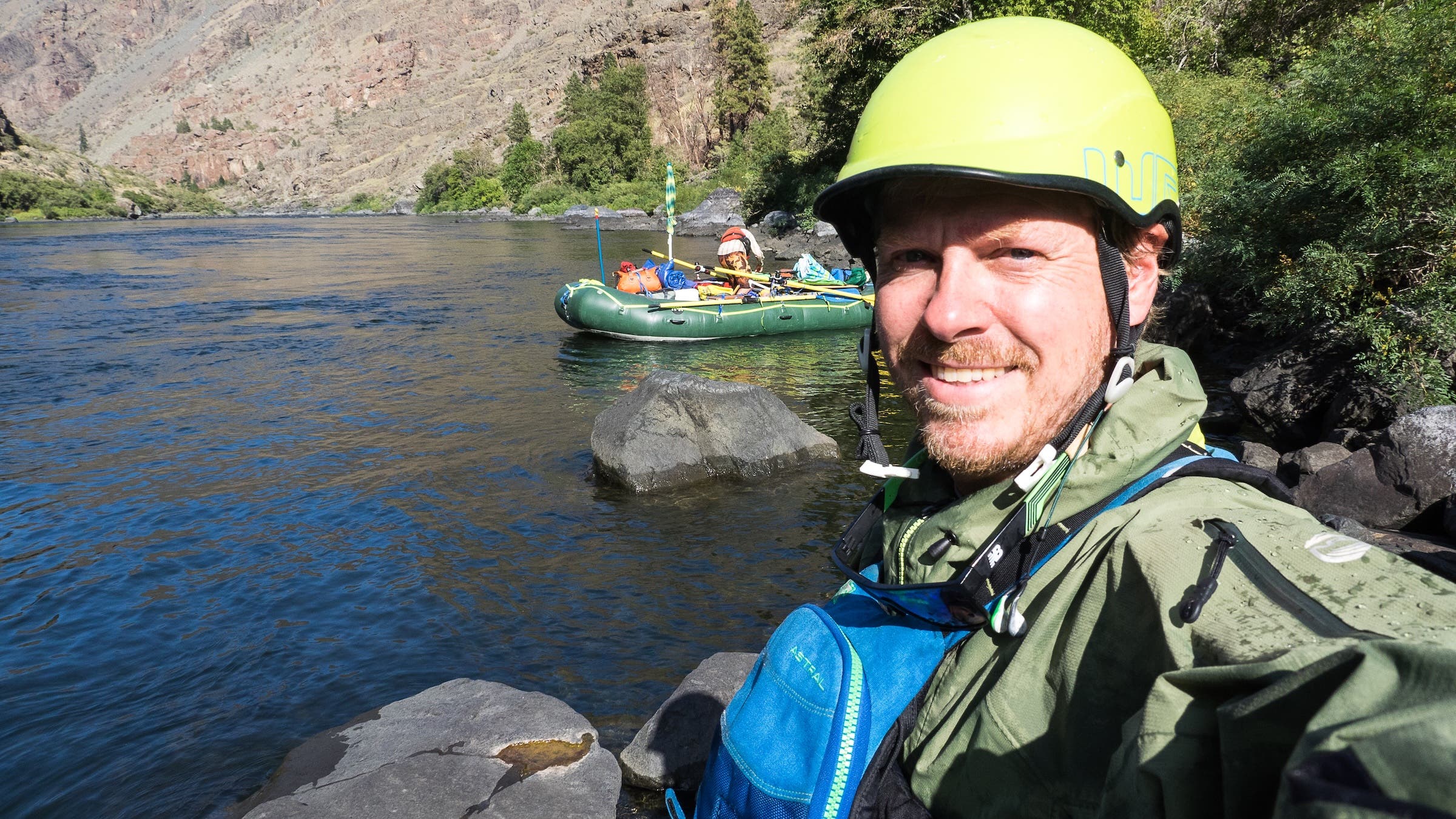
Downstream is the classic whitewater of Hells Canyon, the deepest gorge in the U.S. My college pal from NorCal drove up and we ran a raft and kayak for four days, which confirmed the history. There was no way to get a wagon through this volcanic canyon, so emigrants had to surmount a forgotten range.
The Blue Mountains of Oregon
Upon crossing the Snake River, congrats, you’ve made it to Oregon! Yep, the Willamette Valley is still 350 miles away. No need to rush. Near Baker City, the National Historic Oregon Trail Interpretive Center is the long name of an excellent BLM museum with short trails winding around OT traces.
Further west, La Grande is a friendly gateway town to the Blue Mountains. Check out Side A Brewing in an old fire station. The Blues are where I stumbled across a new favorite adventure: mountain biking the remote Umatilla Rim Trail. There are several starting points, northwest of Elgin, with the most accessible being Horseshoe Prairie Trailhead just off OR-204.
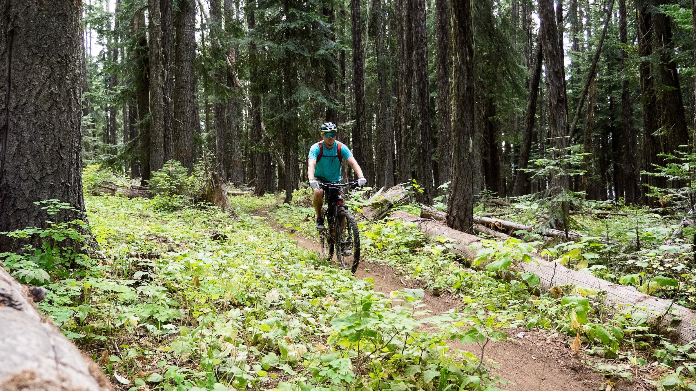
When I first pulled up, some locals over-hyped the difficulty of this trail. Very hard, a black diamond, prep your final will and testament. I packed full kits for repair and first aid. Instead, I found a flowy blue trail of volcanic dirt running for nearly 14 miles through Pacific Northwest forests and along the edge of a golden-grass canyon. You can tack on connector trails and forest roads to create some epic loops. The Umatilla Rim Trail is also great for day hiking, or backpackers can ramble downhill on side-trails into the North Fork Umatilla Wilderness.
I made sure to stop in Pendleton for the most unique of all OT museums. Operated by the Confederated Tribes of the Umatilla Indian Reservation, the impressive Tamástslikt Cultural Institute interprets Westward Expansion from the Native perspective. During an illuminating visit, we also made major discoveries related to my investigation of Native explorer Moncacht-Apé. Finally, I donned cowboy attire and attended the fun Pendleton Roundup, a rowdy rodeo mixed with tribal events.
Beyond Pendleton, I detoured north to Whitman Mission National Historic Site, near the Columbia River. This small NPS unit tells a tragic story from the OT days. Arriving in 1836, missionaries Marcus and Narcissa Whitman believed God had mandated them to convert the local tribes to a strict Christian way of life. Like other emigrants, they also brought diseases that decimated Native populations.
In 1846, long-simmering tensions erupted during a deadly measles outbreak, and a small Cayuse war party killed the Whitmans and other colonists. This fomented a deadly multi-year war, with the OT settlers eventually offering a truce in exchange for the surrender of the mission attackers. During U.S. expansion, so-called “frontier justice” was rarely about establishing guilt beyond a reasonable doubt; it was about a tit-for-tat exchange of violence. Five Cayuse men, three of whom were not involved in the Whitman massacre, were convicted during a controversial trial and publicly hanged by the settlers.
Through the Columbia River Gorge
Today, despite knowing the real history, you can still end an OT retracing on an uplifting note. Next comes a dramatic descent into the Columbia River Gorge. Many emigrants swapped wagons for rafts to float the treacherous waters. Later, the dangerous Barlow Toll Road opened, allowing a mountainous passage to the Willamette Valley. Today, the historical route leads to hiking trails on the flanks of Mount Hood.
Down near Portland, there’s an End of OT Museum and Fort Vancouver National Historic Site, where the independent-minded Dr. John McLoughlin was said to offer assistance to all who needed it. He defied his British superiors and aided the starving U.S. settlers. He differed from the American agenda of conquest and maintained generally positive relations with Natives. For his efforts, McLoughlin came to be called the Father of Oregon.
Today, the plains, mountains, deserts, and rivers along the Oregon Trail are forever changed by what happened in the mid-1800s. Yet you can still learn the true stories and find occasional places where the landscape remains relatively unchanged.
A good OT adventure to end with comes at the posh-meets-outdoorsy town of Hood River. Running through the busy Gorge, there are several feats of transportation innovation. The most recent is the modern I-84. Before that came a historic highway that, during the automobile era of the 1920s, supplanted the passenger trains of the 1880s that had superseded the OT. Today, the Historic Columbia River Highway State Trail is a walking and cycling path located midway up the cliffs. From these breezy heights, you can barely see the development below. Instead, keep an eye out for kiteboarders plying the blue waters of the Columbia that still shimmer on their way toward the Pacific.