
")
Published March 17, 2026 05:00AM
This story was produced in partnership with RE:PUBLIC Lands Media, an independent, nonprofit news organization. Sign up for RE:PUBLIC’s newsletter here.
Most Americans have at least one place they hold sacred—a national park traveled to as a kid; a secret wilderness campsite discovered on a first solo backpacking trip; or a river paddled with buddies for decades. These experiences are the definition of American freedom.
The federal government manages a profound amount of land and water—roughly 640 million acres, about 28 percent of our country’s mass. That’s more than 1.5 times the size of Alaska. The gold standard is our national park system, yet that’s only 85 million acres, one-eighth of the pie. The rest is administered by the Bureau of Land Management (245 million acres), the U.S. Forest Service (193 million acres), and the U.S. Fish and Wildlife Service (95 million acres). A fifth agency, the Department of Defense, manages about 26 million acres. All of these lands overlap with the traditional homelands of Native peoples whose ancestors have been here for millennia.
To “manage” implies good stewardship. To have policies in place that protect the plants, animals, ecosystems, and people who live in or near these places. But that task was made more difficult last year, thanks to mass layoffs and reorganizations of federal agencies. Eighty-six percent of Bureau of Land Management (BLM)–managed land is currently unprotected. The Forest Service estimates the country loses 6,000 acres of public and private open space to residential, commercial, or industrial conversion every day. That’s four acres per minute.
There is barely a safe scrap of public land in this country. Cape Hatteras National Seashore in North Carolina is literally being washed off the map; the Boundary Waters Canoe Area Wilderness in Minnesota is under the omnipresent threat of copper mining; and the BLM management plan for Grand Staircase–Escalante National Monument in Utah is being undone by the state’s own Congressional delegation.
So how did we choose the most endangered public lands? RE:PUBLIC interviewed a diverse array of stakeholders, from wildland-management professors to policy advisors from previous administrations to career conservationists in organizations like the Trust for Public Land, the Wilderness Society, the National Parks Conservation Association, and the Conservation Lands Foundation. We asked each of them: “What keeps you up at night? What brings you hope? And what motivates people to act?”
The threats to our public lands are greater than the ten listed below. That’s because many of those threats—like climate change, staffing cuts, and federal agency reorganization—affect the situation across the board. What’s more, the pace of attack is moving at lightning speed. Some public lands shot to the top of our list because of expedited executive orders or challenges to their protected status by members of Congress, while other threats languished in litigation.
The ten places we chose are not the only critically threatened public lands. But each one is emblematic of an imminent danger. Some of the damage is preventable. We have the tools—science, data, new technology—we need to solve myriad problems on public lands. Hope is still on the table. There are smart people working on solutions, but they need help and a lot of it.
“All of these lands are invaluable and need to be considered as such,” says Ryan Callaghan, the CEO and president of Backcountry Hunters and Anglers. “But we’ve all got to be involved. It’s not enough to buy licenses, tags, stamps,” or, for that matter, national park entry passes. “We’ve got to be involved in policy and advocate for these places.”
1. Boundary Waters Canoe Area Wilderness
Minnesota; Managed by the U.S. Forest Service
The Place: One million acres of pristine boreal forest surrounding glacial lakes and streams, the Boundary Waters Canoe Area Wilderness (BWCAW) is within the Superior National Forest, which contains 20 percent of all the freshwater within the U.S. National Forest Service system. The traditional homeland of the Anishinaabe people, it’s home to wolf, moose, black bear, lynx, and that mysterious red-eyed state bird, the common loon. Even with strictly regulated points of entry, the BWCAW averages 150,000 visitors per year, making it the most beloved wilderness area in the country.
The Threat: In January, the House of Representatives voted to overturn the Biden Administration’s 20-year moratorium on mining within 225,000 acres of the Superior National Forest, directly south of the Boundary Waters. The resolution, introduced by Representative Pete Stauber (R-Minnesota), used a novel interpretation of the Congressional Review Act to nullify the mining ban and prevent Congress from re-introducing another ban. (The CRA, incidentally, is the same tool Senator Mike Lee (R-Utah) and Representative Celeste Maloy (R-Utah) are using to try to nullify the management plan for Grand Staircase–Escalante National Monument.) The Senate has until the end of April to vote on the measure. The situation is so crucial that, for the first time, four descendants of President Theodore Roosevelt co-signed a letter to senators urging them to oppose mining near the Boundary Waters. A yes vote would pave the way for Twin Metals, a subsidiary of Chilean-owned mining conglomerate Antofagasta, to re-apply for state and federal permits to operate a proposed copper-nickel mine near Ely, within the Boundary Waters Canoe Area Watershed. If they vote no, the wilderness has a temporary reprieve, but the fight is never over.
The Consequences: Mining has long been part of this region—south and west of the Boundary Waters, iron ore and its derivative, taconite, have been heavily extracted for more than a century. But sulfide-ore copper mining, also known as hard rock mining, has far greater consequences for the environment. When sulfide ore and its waste tailings are exposed to air and moisture, sulfuric acid compounds can create acidic drainage, contaminating lakes, rivers, and groundwater. A path of toxic pollution could stretch from the Twin Metals mine downstream through the Boundary Waters Canoe Area Wilderness, north to Voyageurs National Park, and beyond to Canada. Copper mining also releases environmental toxins, including mercury, arsenic, lead, asbestos-like fibers, and air pollution that impact community health.
The Lead: Save the Boundary Waters is a national campaign created by Northeastern Minnesotans for Wilderness to protect the Boundary Waters from sulfide-ore copper mining. Using political advocacy, science, education, and litigation, the campaign is a well-oiled machine that, along with partner organizations and other advocacy groups like Friends of the Boundary Waters, has been successful so far at keeping the omnipresent threat of mining out of the watershed.
The Hope: “The Boundary Waters is an iconic landscape beloved by Americans from all walks of life and from every corner of the country,” says Ingrid Lyons, executive director of Northeastern Minnesotans for Wilderness. “No matter what happens in Congress, the public—which overwhelmingly supports and wants to protect our country’s most unique landscapes—will always show up for the Boundary Waters to say ‘not this mine, not this place,’ and indeed, that’s what we’ll fight for until the bitter end, with the people by our side, speaking loudly for this quiet place.”
2. Arctic National Wildlife Refuge and National Petroleum Reserve–Alaska
Alaska; Managed by the U.S. Fish and Wildlife Service, the Bureau of Land Management
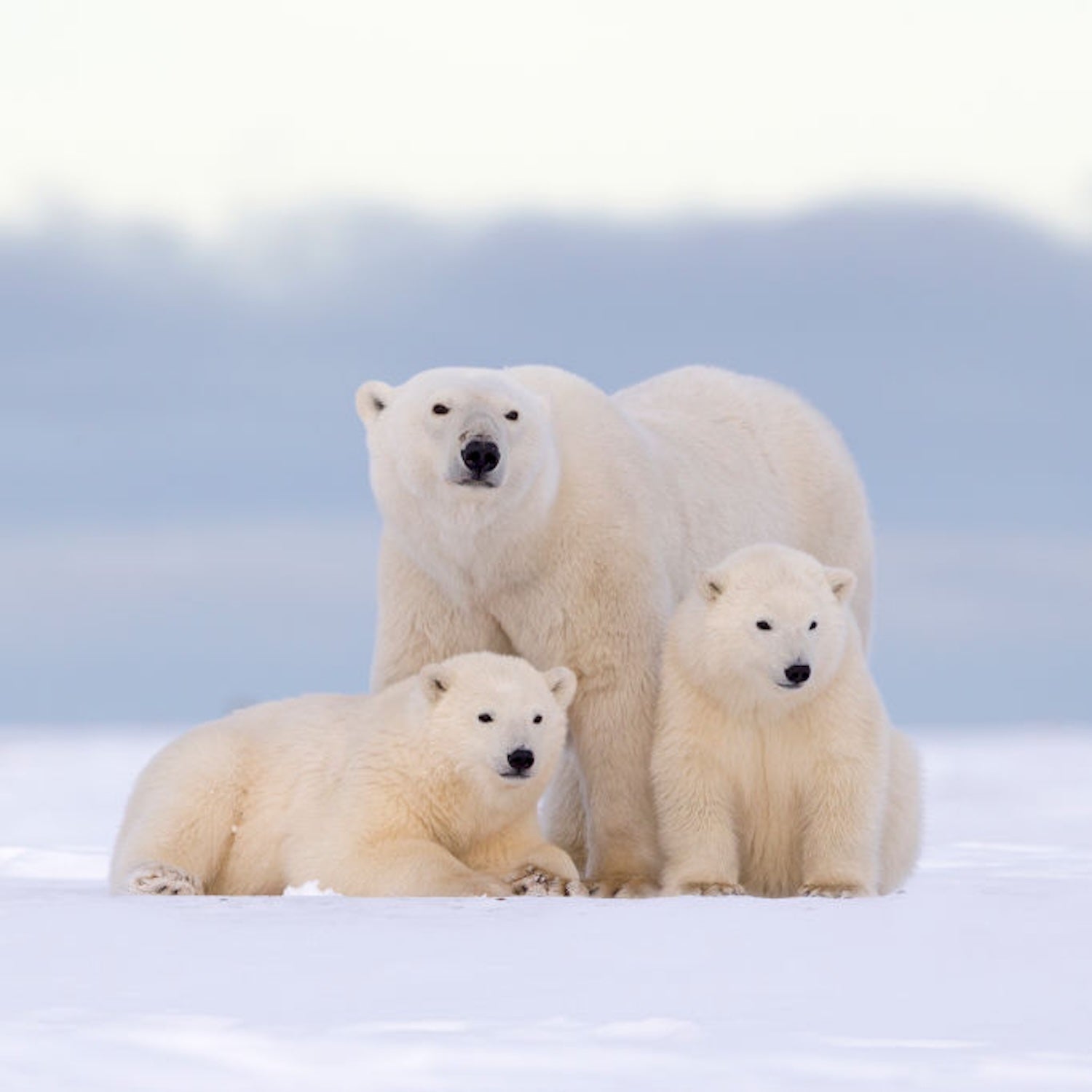
The Place: These two unfathomably huge tracts on the coastal plain of northern Alaska are separated by the oil fields of Prudhoe Bay. To the east is the 19.6-million-acre Arctic National Wildlife Refuge (ANWR), the largest wildlife refuge in the country, a wilderness the size of South Carolina. Managed by the U.S. Fish and Wildlife Service, ANWR is home to the Iñupiat and Gwich’in peoples, the latter of whom rely on the Porcupine caribou herd for sustenance. The refuge also provides habitat for denning polar bears, Dall sheep, musk oxen, and more than 200 bird species.
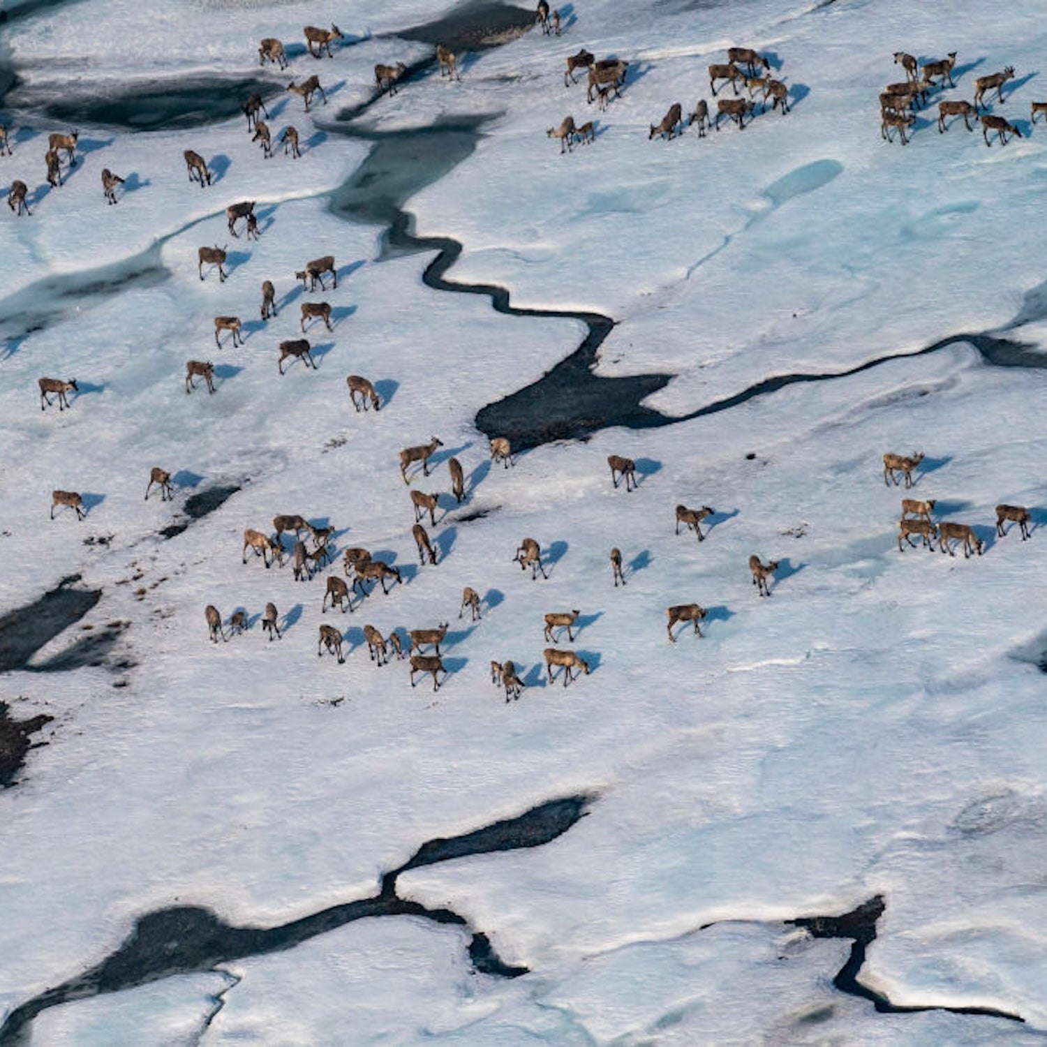
The 23.4-million-acre National Petroleum Reserve–Alaska (also known as the Western Arctic) is, quite simply, the largest block of public land in the nation. It was set aside in 1923 to provide an emergency supply of oil for the U.S. Navy, with protections added in 1976 for Special Areas of biological significance, including Teshekpuk Lake, Colville River, and the Utukok River Uplands. The reserve’s name contradicts its value as one of the world’s most ecologically and culturally significant landscapes, offering critical habitat for migratory birds, brown bear, caribou, threatened polar bears, walrus, and endangered beluga whales.
The Threat: On January 20, 2025, the day President Trump took office, he announced an executive order titled “Unleashing Alaska’s Extraordinary Resource Potential.” He’s kept his promise. Oil and gas exploration is being expedited across the Lower 48 and in federally protected waters, including those off of Central and Southern California. Here in Alaska, the BLM reinstituted the Coastal Plain Oil and Gas Leasing Program paused by the Biden administration in 2021. The program re-opens the 1.56 million–acre Coastal Plain of ANWR to development. The Alaska Industrial Development and Export Authority already owns leases here and plans to develop them; but the Department of Interior has mandated no fewer than four additional lease sales by 2035. In November, the BLM rescinded a 2024 rule clarifying its legal obligation to protect critical wildlife habitat, stripping protections from 23 million acres of the NPR-A, including more than 13 million acres designated as Special Areas. As of last December, nearly 82 percent of the reserve has been reopened to oil and gas production.
The Consequences: The Alaskan Arctic has some of the most ecologically and culturally sensitive public lands in the country. Its wetlands act as a carbon sink that will be destroyed by the massive infrastructure required to drill. Irreplaceable caribou calving grounds and globally significant migratory bird habitats will be decimated if development continues at its current accelerated pace. Local communities face increased risk to health and food security. Yet oil and gas leasing continues to ramp up in Alaska, with limited, if any, environmental review. In November, the BLM released plans from ConocoPhillips to expand the scope of its already controversial Willow Project in the NPR-A, which is estimated to produce 180,000 barrels of oil per day at its peak, to include new seismic studies and exploratory wells. The Bureau gave the public, including impacted Native communities, seven days to comment. In December, environmental groups filed suit, and a federal judge has allowed the project to proceed while the court decides the case.
The Lead: The Arctic Defense Campaign works with a coalition of about 30 other organizations to protect Arctic Alaska from destructive oil development, including smaller local initiatives like Sovereign Inupiat for a Living Arctic.
The Hope: “The Reserve and its five Special Areas protect ecosystems found nowhere else on Earth, support local economies through world-class recreation, and strengthen climate resilience at a time when we can least afford to lose them,” says Katherine Catalano, director of the Arctic Defense Campaign. “We need every voice, nationwide, to speak up and urge their members of Congress to act. By collectively raising our voices, we can push back against the oil and gas lobby and defend this vast, irreplaceable landscape.”

3. Independence National Historical Park and Others
Nationwide; Managed by the National Park Service
The Places: Across the entire national park system, signs and displays educating visitors about enslavement, mistreatment of Native people by settlers, LGBTQ+ rights, women’s rights, climate change, and environmental protections are disappearing. In Acadia National Park, rangers removed signs exploring how to better manage the ecosystem amid increasing heat and extreme weather. At Muir Woods National Park, signs exploring Indigenous history, the park’s racist past, and the role of women in protecting the park were taken down. Even the rainbow-colored Pride flag at Stonewall National Monument in Manhattan was quietly lowered.
Some of the most heavy-handed censorship is at NPS sites where discussion of slavery is a central theme. At the President’s House site at Independence National Historical Park in Philadelphia, installations referring to George Washington’s ownership of enslaved people were removed. Across the South, from Cane River Creole National Historical Park in Louisiana to Fort Sumter and Fort Moultrie National Historical Park in South Carolina, exhibits and books that discuss the treatment of enslaved people were flagged by park staff for potential removal. Eighty items were flagged for removal at the Selma to Montgomery National Historic Trail in Alabama, which commemorates the route Martin Luther King Jr. walked with thousands of others to demand voting rights in 1965.
The Threat: In March 2025, President Trump issued an executive order titled “Restoring Truth and Sanity to American History,” aimed at purging federal parks and museums of displays that cast the nation’s history in a “negative light.” In May, Interior Secretary Doug Burgum enforced that order with a directive to eliminate depictions at Park Service sites that “inappropriately disparage Americans past or living (including in Colonial times),” instituting a mandatory review process of potentially offending material. The Department of the Interior is now carrying out that order. According to the Washington Post, an anonymous group calling itself “Civil Servants on the Front Lines” leaked the NPS database tracking the targets, which went so far as to include junior ranger booklets mentioning slavery.
The Consequences: “We have spent the last 30 years helping the National Park Service (NPS) to ensure that their interpretation of American history is more accurate, more just, and more inclusive,” says Alan Spears, the National Parks Conservation Association’s Senior Director of Cultural Resources. “These directives ball up and throw away all the progress we’ve made.”
The Lead: The National Parks Conservation Association (NPCA) is tracking what is being removed and has an efficient process on its website to contact congressional representatives. In February, the NPCA and a broad coalition of scientists, historians, and advocates, including the Association of National Park Rangers, filed a lawsuit in the U.S. District Court for the District of Massachusetts to halt the Trump administration’s efforts to censure science and history. Additionally, a community collaboration called Save Our Signs is building a “People’s Archive” of photos documenting exhibits, signs, and other items across the National Park Service before their potential removal.
The Hope: The good news is that some displays have already been restored. New York City officials re-raised the Stonewall pride flag, and a U.S. District judge, quoting George Orwell’s dystopian novel 1984, ordered the National Park Service to reinstall exhibits at the President’s House in Philadelphia. So far, however, it’s hit or miss as to what is being restored elsewhere. “My hope is that we come to understand this country has a deep, broad, complex history, and that much as we might have tried, we didn’t always get things right, but that’s us, too,” says the NPCA’s Alan Spears. “Abraham Lincoln told us to live up to our better angels. It’s got to be the public that gets activated and engaged enough to tell the administration that they are doing the wrong thing.”
4. Big Bend National Park
Texas; Managed by the National Park Service
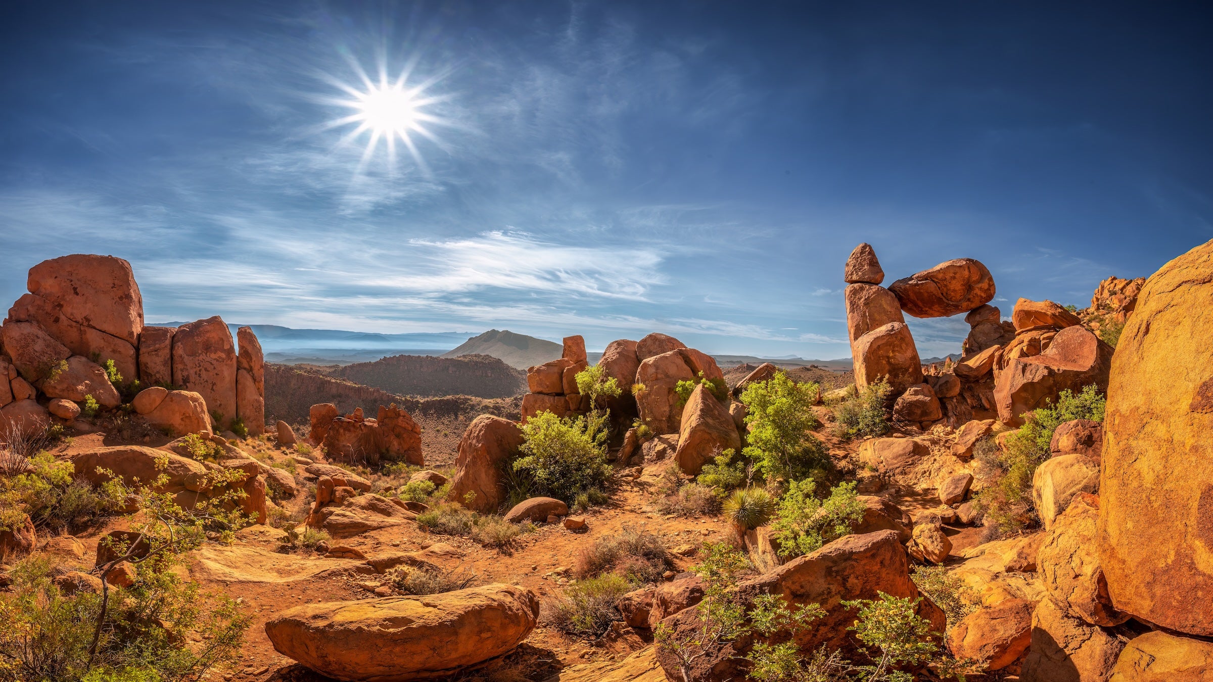
The Place: Big Bend National Park is larger than the state of Rhode Island, a swath of Chihuahuan Desert canyons and mountain ranges so vast that rangers who have worked in the park for decades have yet to explore it all. They are not the first to try. Humans have passed through here for 13,000 years, leaving traces at roughly 2,500 documented archaeological sites within the park’s 800,000–plus acres. Its lifeblood is the 196-mile ribbon of the Rio Grande, a fraction of the mighty river that historically flowed 1,900 miles from Colorado’s San Juan Mountains to the Gulf of Mexico. Lining the river in one famous stretch are the 1,500-foot walls of Santa Elena Canyon, and the park’s riparian zones are a haven for migratory birds, monarch butterflies, and big mammals like black bears that meander between international boundaries.
The Threat: “Every couple of years, it’s another hit,” says Tara Shackleford, owner of Hidden Dagger Adventures, whose ancestors began ranching near the gateway town of Marathon in the 1800s, long before the park was established in 1944. The first hit is the severe lack of water in the Lower Rio Grande. A dark joke among guides is that the river is the greatest place to go for a hike. Portions of it upstream from the national park are now permanently dry due to a multi-decade drought, poor management, outdated infrastructure, and inadequate federal funding. Hit number two was the Department of Homeland Security’s (DHS) plan, announced in mid-February, to expedite border wall construction along the entire 517-mile stretch of U.S. Customs and Border Patrol’s Big Bend Sector, which includes Big Bend Ranch State Park and Big Bend National Park. According to the agency’s website, the “Smart Wall” would be a combination of “steel bollard wall, waterborne barriers, patrol roads, and the technology required to tie it all together, such as cameras, lights, and other detection technology.” In some places, a physical wall would completely cut off access to the river, creating panic and anger among residents, many of whom rely on tourism for their livelihood. But hours after President Trump announced that he fired DHS Secretary Kristi Noem, that Smart Wall schematic was quietly replaced with a virtual wall of “Detection Technology.” Whether this rare piece of good news will last remains to be seen.
The Consequences: First, drought: in January, the park had to close Chisos Mountains Lodge, its only hotel, after antiquated water pumps at Oak Springs—the sole water source for the popular Chisos area—failed completely. Federal funds designated through the Great American Outdoors Act will upgrade the water system starting in May, but there was already another leak on February 25, re-emphasizing the absolute “importance” of the upgrade, according to park officials. As for the border wall, residents are relieved—and still wary. “My family is here because of the beauty and wildness of this land,” says Shackleford. “If illegal border crossings were a problem and we feared for our safety, we wouldn’t be able to have a ranch. But we’ve never had an issue. Our future, our business, and our family is here in Marathon. A wall would be a hard, hard hit.”
The Lead: Watch Ben Masters’ documentary The River and the Wall, which follows five friends on an adventure from El Paso to the Gulf of Mexico. The Texas Water Foundation is an Austin non-profit that educates people on how to help move Texas toward a more secure water future. Learn more at American Rivers, which listed the Lower Rio Grande as the Fifth Most Endangered Waterway in 2025.
The Hope: News of the border wall came with fast and furious opposition, including bipartisan backlash and a Change.Org petition signed by more than 86,000 people. These two factors may have had some influence on the physical barrier being scrapped. As for the lack of water in the Lower Rio Grande? “The situation is reversible if there is willingness to reverse it,” says Rosario Sanchez, senior research scientist at the Texas Water Resources Institute at Texas A&M University. “And it needs to be on a basin level regardless of boundaries. Otherwise, we will keep seeing what we are seeing: limited commitment, delaying strategic actions from all users, mainly ag users, governmental institutions resisting change due to political priorities, and a dying river. Actions to reverse the status quo are costly, and nobody wants to take that risk. But they will be more costly if we keep delaying them. It is just a matter of time.”

5. Manassas National Battlefield Park
Virginia; Managed by the National Park Service
The Place: This historic park preserves the sites of two major Civil War clashes: The First Battle of Manassas (Bull Run) on July 21, 1861, was the first major battle of the Civil War. The Second Battle of Manassas, a year later, engaged twice as many soldiers and had five times the number of casualties. Beyond the Civil War battlefields, the 5,000-acre park also contains 50 miles of trails and one of the last native grasslands in the region.
The Threat: Last July, President Trump issued an executive order, “Accelerating Federal Permitting of Data Center Infrastructure,” that will streamline permitting reviews, provide financial support, and use federal land to facilitate the construction of data centers. But these vast storage facilities are already cropping up everywhere, from Texas to the Great Lakes states. Virginia takes the number one spot with more active and planned data centers than anywhere else in the world. The Prince William Digital Gateway—slated to be the largest data center campus of its type on earth, sprawling across 1,700 acres with 37 buildings and a footprint four times the size of the Pentagon—will be built along the western border of Manassas National Battlefield Park, near the site of the Second Battle of Manassas.
The Consequences: Last year, sales tax exemptions for data center sites cost the state of Virginia $1.6 billion, about 16 times initial projections. A 2024 independent review commissioned by the state found that to meet the energy demands for data centers that are already on the table, Virginia would have to build a new natural gas plant every two years for 15 consecutive years, increase nuclear power generation, double the state’s rate of solar deployment, double the amount of energy being imported from other states, and increase wind energy generation. The effects on Manassas National Battlefield include viewshed impacts, noise pollution, degraded drinking water, decreased access to recreation, and an unsustainable drain on energy. Then there’s the desecration of a major Civil War battle site, including a camping ground where hundreds of Confederate soldiers who died of measles are likely buried.
The Lead: Two separate lawsuits opposing the data center are making their way through the courts. Because of the similarities in the two cases, the Virginia Court of Appeals held a combined hearing for oral arguments on February 24. The verdict from the three-judge panel is pending, and construction is on hold. Track the updates at The American Battlefield Trust, one of the plaintiffs. The National Parks Conservation Association is also tracking other proposed data centers that will impede national park entities.
The Hope: “Our hope is that projects like the Digital Gateway do not get built,” says Kyle Hart, mid-Atlantic senior program manager for the NPCA. “We are willing to fight tooth and nail, or the developers can make the responsible choice that some places are too precious to build data centers. Any state considering data center development needs to pass reforms, improve government transparency, and accountability. As data centers are built, we need to be accounting for environmental impacts, whether that’s new power plants, power lines, or impacts to water.”

6. Red Cliffs Desert Reserve National Conservation Area
Utah; Managed by the Bureau of Land Management
The Place: The Red Cliffs Desert Reserve was established in 1996 as part of a compromise to protect 62,000 acres of public lands for the threatened Mojave Desert tortoise, while simultaneously opening 300,000 acres of state and private lands for development. In 2009, Congress established the 45,600-acre Red Cliffs National Conservation Area within the reserve. Managed by the BLM, this arresting landscape directly north of the fast-growing city of St. George, has soaring cliffs of red Navajo sandstone and is critical habitat for 20 species of sensitive and threatened wildlife. It also contains more than 130 miles of trails, two wilderness areas, and Indigenous cultural artifacts.
The Threat: For decades, Utah politicians have pushed a controversial plan to build the Northern Corridor Highway, a four-lane thoroughfare through the middle of the National Conservation Area, despite legal challenges, strenuous local opposition, and a 2024 analysis from the BLM that demonstrated viable alternative routes. In January, the Trump administration reversed a December 2024 rejection of the highway proposal, marking the eighth time the project has been considered. On every previous attempt it was halted over concerns about wildlife, increased wildfire probability, public safety, legal compliance, and community opposition.
The highway is emblematic of the state’s power grab for federal land, from a congressional delegation seeking to shrink Grand Staircase–Escalante and Bears Ears National Monuments to a bill asserting that Utah has “legislative jurisdiction” over 96 percent, or 35 million acres, of federal land in the state. If passed, the legislation will open the door for logging, mining, and development.
The Consequences: Building a highway along Washington County’s preferred alignment will increase development on private and state trust lands adjacent to the national conservation area. “Bulldozing a four-lane highway through a national conservation area that Congress protected by law is a betrayal of the public’s trust to protect this landscape and puts every single acre of America’s protected public lands at risk,” says Charlotte Overby, vice-president of Conservation Field Programs for the Conservation Lands Foundation.
The Lead: On March 1, the U.S. district court granted a motion by environmental organizations led by Conserve Southwest Utah to block ground-disturbing activities associated with building the highway in order to protect the Mojave desert tortoise. In granting the injunction, the judge found the lawsuit is likely to succeed in showing that the highway approval is unlawful.
The Hope: “We need everyone’s voices on this one,” says Overby. “Today it’s Red Cliffs. Tomorrow it could be any of the millions of acres of protected public lands Americans and rural communities depend on.”
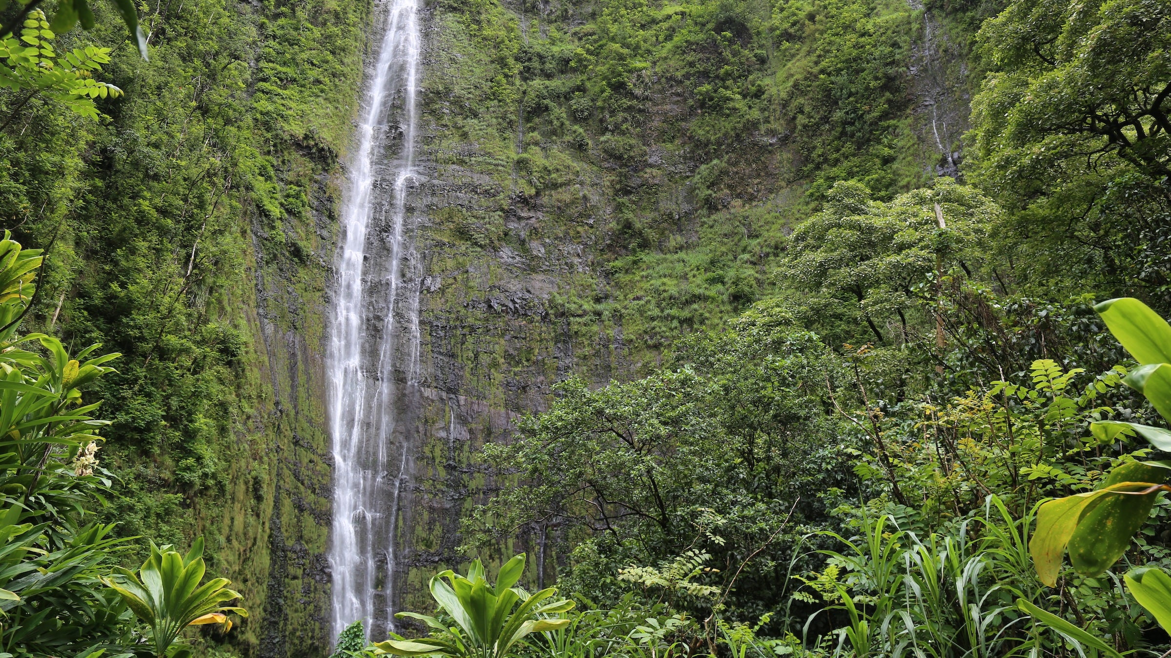
7. Haleakalā National Park
Hawaiʻi; Managed by the National Park Service
The Place: Haleakalā, or “House of the Sun,” the dormant shield volcano that rises 10,023 feet into the clouds on the island of Maui, has been a spiritual center for Native Hawaiians for at least a thousand years. The surrounding 30,183-acre Haleakalā National Park harbors 103 endangered species—81 flowering plants, ten birds, six non-flowering plants, three insects, two mammals, and one reptile— more than any other U.S. national park.
The Threat: More and more species are at risk of extinction due to habitat fragmentation and climate change. At the same time, the Endangered Species Act is being gutted. In November, Interior Secretary Doug Burgum announced that his department is restoring the law to its “original intent, protecting species through clear, consistent and lawful standards that also respect the livelihoods of Americans who depend on our land and resources.”
To see extinction in action, look no further than Hawaiʻi, which contains the most concentrated number of endangered species in the U.S. The most critically imperiled are its endemic honeycreepers, bright and beautiful tropical songbirds that used to fill the forests with their melodious trill. Once as ubiquitous as the American Robin is in the Lower 48, honeycreepers have declined from more than 50 species to 17, some with fewer than 500 individual birds. Six of those species are within Haleakalā National Park. One, the ‘I‘iwi, is listed as threatened. Two others, the Kiwikiu and ‘Akohekohe, are endangered.
Part of the threat is longstanding: the birds have been decimated over the last two centuries by avian malaria, habitat fragmentation, and predatory invasive species. Enemy Number One is the mosquito, accidentally brought to the islands on whaling ships in the 1800s. Some honeycreeper species are so sensitive to avian malaria that one bite from an infected mosquito can be fatal. As temperatures have increased across the islands, the birds’ range has crept upward to the highest elevations in the national park where, so far, the mosquitoes can’t survive.
The Consequences: Without swift action, avian malaria will force the extinction of several species of honeycreepers across Hawaiʻi within ten years. In Halakalā National Park specifically, budget cuts are impeding conservation efforts, which prompted a bipartisan group of legislators to cite the park in a letter they sent to Interior Secretary Doug Burgum last December. “At Haleakalā National Park,” the U.S. representatives wrote, “staffing shortages are delaying critical conservation work and backcountry maintenance, limiting both visitor access and protection of endangered species.”
The Lead: Across the islands, a consortium of partner organizations under the umbrella of Birds Not Mosquitoes is working on mosquito birth control. The method uses a naturally occurring bacterium called Wolbachia that lives in the tissues of many insect species. If males and females carry different Wolbachia strains, their eggs don’t hatch. Since November 2023 on the island of Maui, Maui Forest Bird Recovery Project has been releasing male mosquitoes with an incompatible strain in an effort to suppress mosquito populations and reduce disease transmission.
The Hope: “These birds are priceless parts of our biodiversity,” says Chris Farmer, Hawaiʻi program director of the American Bird Conservancy. “They are part of the native ecosystem and part of the earliest Native Hawaiian indigenous tradition. To have a honeycreeper once again as a backyard bird would be an incredible success.”
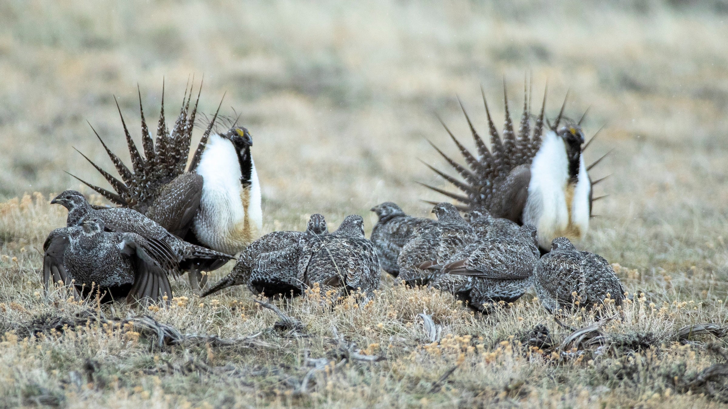
8. Rock Springs Planning Area
Wyoming; Managed by the Bureau of Land Management
The Place: The largest unfenced area in the Lower 48, the Rock Springs Planning Area is 3.6 million acres of BLM-managed public land in southwestern Wyoming encompassing the Red Desert, one of the last high-desert ecosystems left in North America, and the Golden Triangle, a region of sagebrush and sweeping views that contains the highest-density sage grouse population on earth and the largest historical herd of pronghorn in the continental U.S. The world’s longest documented mule-deer migration–480 miles round trip–passes through. For 12,000 years, humans have understood the magic and bounty of this place, whose descendants, including the Eastern Shoshone, Cheyenne, Crow, and Shoshone Bannock, consider it sacred
The Threat: The current BLM Rock Springs Resource Management Plan, finalized in 2024, was 12 years in the making. A community-driven, balanced land use plan, it included significant protections for cultural areas, wildlife habitats, wildlands, and recreation areas while making 70 percent of the planning area available to oil and gas leasing. In May 2025, however, the U.S. Geological Survey published a new assessment proclaiming massive amounts of previously undiscovered oil and gas technically recoverable in the area. Using that assessment as its impetus, the administration recently ordered the BLM to amend its 2024 plan that will allow for oil and gas development in exclusion areas that are havens for wildlife.
The Consequences: Scoping for the amended plan wrapped up in December, and environmental groups anticipate that the draft resource management plan will be released within the next few months. When it is released, it’s critical that public comments push to retain conservation designations from the 2024 plan. If the agency is successful in removing those protections, there could be adverse impacts, like the destruction of sensitive landscapes and disruption of critical migration routes that could impact wildlife as far away as Grand Teton National Park.
The Lead: Founded in 1967, the Wyoming Outdoor Council works to protect the state’s public lands, which comprise half the state. “With efforts underway to amend the Rock Springs Resource Management Plan as a giveaway to industry interests, it’s up to the public to speak up and tell the Bureau of Land Management to retain protections for this iconic landscape,” says Alec Underwood, conservation director of the organization.
The Hope: “My hope is that the BLM is going to recognize the outstanding wildlife and recreation values in those areas and continue to uphold management that can protect those values for well into the future,” says Underwood. “Conservation rarely happens by accident, and there has never been a more important time for public lands advocates to elevate their voices so that we can ensure these places stay intact for current and future generations to enjoy.”
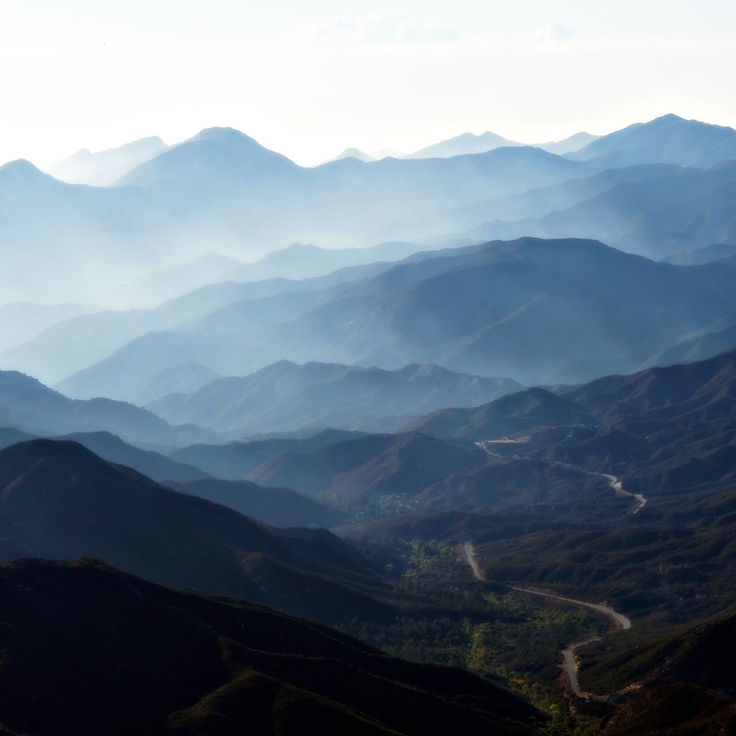
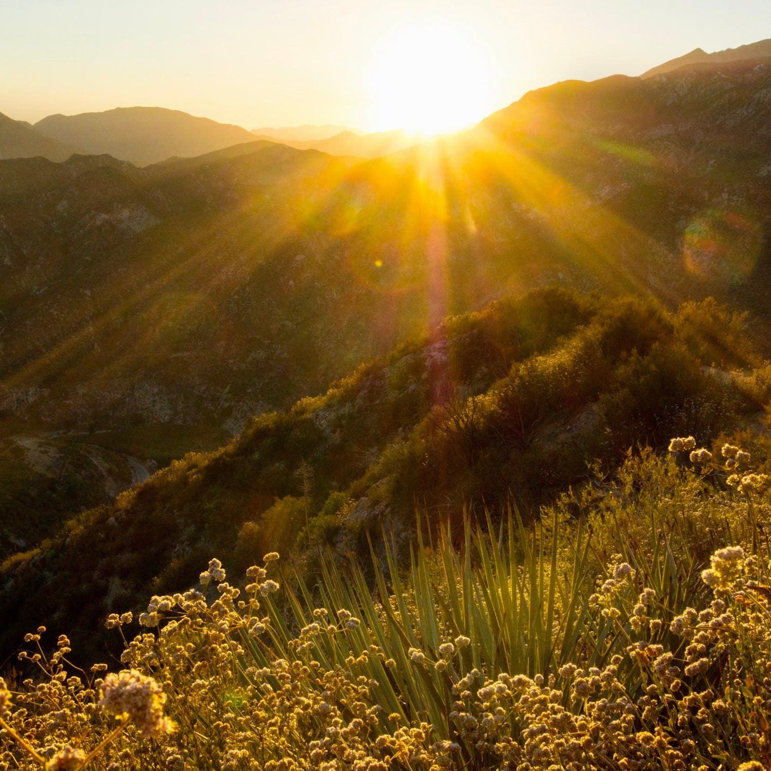
9. Angeles National Forest
California; Managed by the U.S. Forest Service
The Place: Set aside in 1892, California’s first national forest is the backyard playground for almost 20 million people who hike, ski, mountain bike, and climb to the summit of 10,064-foot Mount Baldy. The 700,000-acre Angeles National Forest also contains the headwaters of the Los Angeles River, a 51-mile waterway that flows through more than a dozen cities—and a lot of concrete—to the Pacific Ocean at Long Beach.
The Threat: We can’t predict where fires are going to break out, but last year’s Eaton Fire is illustrative of an increasing threat to cities in the West. On January 7, 2025, flames swept through the San Gabriel Mountains and downward into foothill communities like Altadena. Fueled by fierce Santa Ana winds blowing at up to 100 mph, the fire killed 19 people and destroyed more than 9,000 buildings, making it the fifth deadliest and second most destructive wildfire in California history. Together with the Palisades fire to the west, the two were the most costly in history, causing losses of $65 billion.
Deadly fires are increasing in frequency in the West, primarily due to climate change, an expansion of the wildland-urban interface—and the rapidly increasing speed of fire. Fire speed has shot up by 250 percent in the past two decades, fueled in part by hotter, drier, and windier weather; native vegetation being overtaken by faster-burning invasives; and an increase in flammable manmade structures, according to a recent study from the University of Colorado Boulder’s Cooperative Institute for Research in Environmental Sciences (CIRES). “Any populated area in the West is now at risk,” says Matthew Bitters, a fire-risk and forest resilience manager at the university, “especially when you couple that with wind events.”
The Angeles National Forest and its surroundings contain all the necessary ingredients for another inferno: namely the manmade structures of 20 million people, increasingly volatile Santa Ana winds, and a fire season that is now year-round. Add in the snow drought that the greater West has experienced this winter, and you have the conditions for high wildfire potential in the months ahead.
The Consequences: For people living on the forested fringes of urban areas in the West, says Bitters, “it’s not a question of when there’s going to be a fire, it’s a question of how bad.” An independent analysis of publicly available U.S. Forest Service data by the nonprofit Grassroots Wildland Firefighters found that “hazardous fuels reduction work across USFS lands was, as of the end of September, down 38 percent in 2025 compared with the same period over the previous four calendar years. This precipitous decline of wildfire prevention work in high-risk areas—in conjunction with the failure to retain, hire, and train wildland firefighting personnel—heightens the risk of catastrophic wildfires.” In January, the Department of the Interior announced plans to establish a new U.S. Wildland Fire Service, consolidating the Forest Service and Department of the Interior fire-management programs. But Congress declined to fund its $6.5 billion budget, with Democrats asking that the rollout be delayed until fundamental questions could be answered.
The Lead: Grassroots Wildland Firefighters was founded in 2019 by active and retired federal wildland firefighters to confront the immense challenges facing wildland firefighters. The National Fire Protection Association’s Firewise USA program teaches communities how to adapt to living with wildfire and encourages neighbors to work together and take action to prevent property loss.
The Hope: Not all western wildland fires are bad. A forthcoming study by CIRES shows that 49 percent of the area burned in the western U.S. between 2010 and 2020 was because of “low-moderate severity good wildfire.” That was a “staggering” number to Bitters. “Almost 50 percent of fires are good fires,” he says. “If a fire starts in an area considered safe to burn, that can have great benefits and protection of the forest into the future. It’s not all bad.”
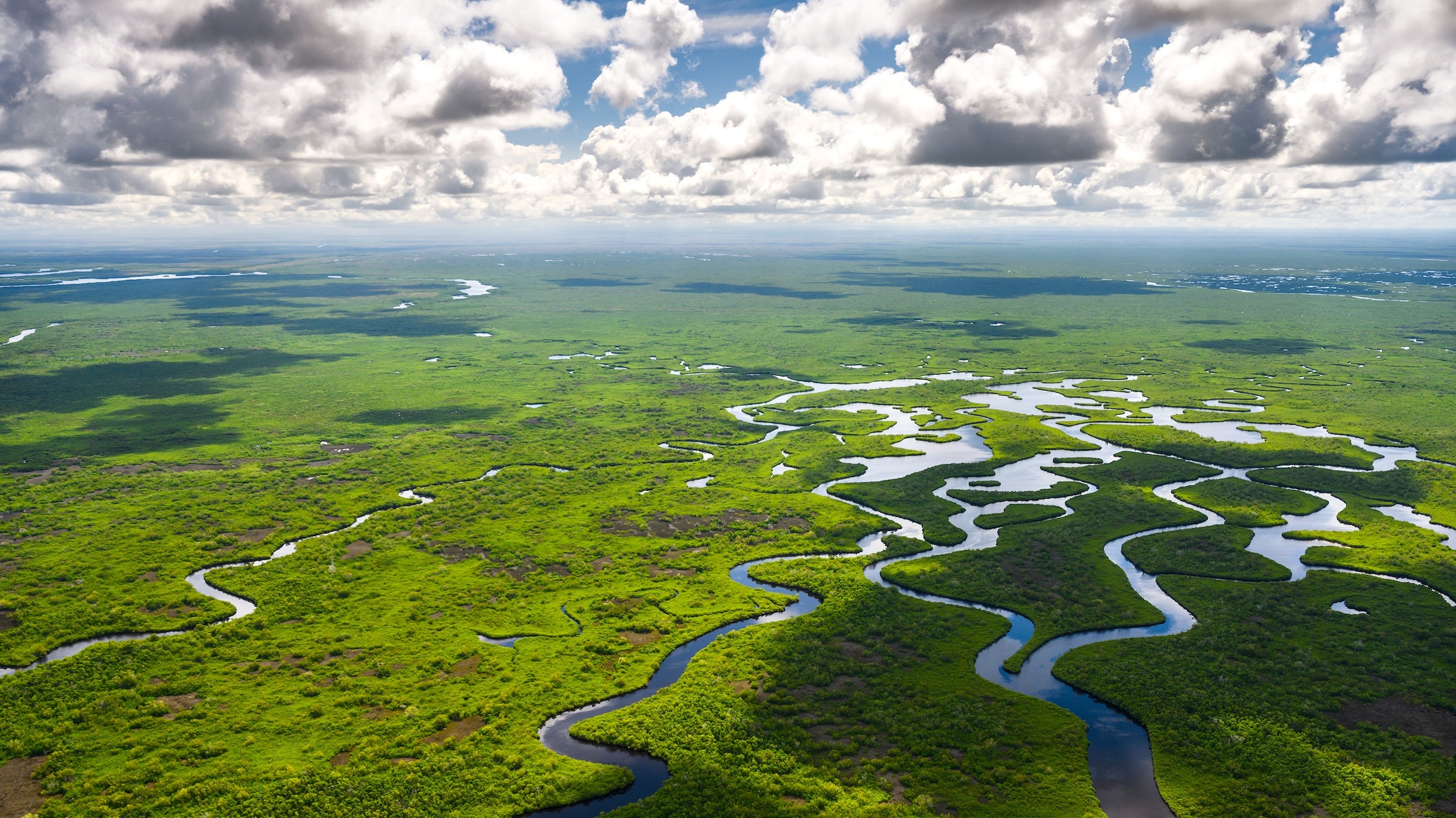
10. Everglades National Park
Florida; Managed by the National Park Service
The Place: The Everglades, a 1.5 million-acre salt and freshwater universe known as the “River of Grass,” once flowed freely across a third of southern Florida, from the headwaters of the Kissimmee River near Orlando through Lake Okeechobee and into Florida Bay. Less than half of its historical range still exists, because of disrupted water flow and compartmentalization. Within it lies Big Cypress National Preserve and Everglades National Park, home to native species like the endangered Florida panther and both the American alligator and the threatened American crocodile.
The Threat: Florida has more invasive species than anywhere else in the country, with feral hogs, green iguana, and Argentine tagu rooting up soils and devouring native plants and wildlife. The most problematic is the Burmese python. Introduced to Florida through the exotic pet trade, the first python was caught in the wild in Everglades National Park in 1979. Their population has since exploded; an estimated 23,000 Burmese pythons have been removed in the last quarter century. Scientists estimate that less than one percent of Burmese pythons are seen or captured—females lay dozens of eggs at a time, and the snake’s coloring allows them to blend in with the environment. In January, in Big Cypress National Preserve, an invasive Burmese python dragged a hunter contracted by the Florida Fish and Wildlife Commission 15 feet before he (and three family members) were able to capture the nearly 17-foot, 202-pound python.
The Consequences: There is no magic bullet for the eradication of the Burmese python in southern Florida. To humans, the snake is nonvenomous, but larger ones have huge, sharp teeth that can cause serious lacerations. In addition to killing domestic cats and dogs and goats and chickens, the Burmese python is primarily responsible for an estimated 90 percent population decline, especially in the eastern Everglades, of medium-sized mammals including racoons, bobcats, marsh rabbits, and fox, a species that is now locally extinct. The snake has also introduced Asian lungworm, a parasite that has decimated native snake species, and new research demonstrates that it is altering how plants spread across the landscape. “Our native wildlife has not evolved along with a giant ambush predator,” says Ian Bartoszek, the lead wildlife biologist at Conservancy of Southwest Florida. “They are like babes in the woods.”
The Lead: The Fish and Wildlife Foundation of Florida, the state’s largest conservation foundation, supports more than a half dozen organizations working to eradicate the Burmese python, including the Conservancy of Southwest Florida, where Bartoszek operates one of the oldest research and removal programs in the state. He’s caught the largest male (16 feet, 140 pounds) and female (18 feet, 215 pounds) by weight on record to date, and once pulled a 35-pound fawn out of a 31.5-pound female Burmese python. He locates the snakes mostly by using radiotelemetry tracking on “scout” male snakes that lead to breeding female pythons. Over the last decade, the Conservancy has humanely euthanized 24 tons of python in less than a 200-square-mile area of the western Everglades.
Two state-run agencies, the Florida Fish and Wildlife Conservation Commission (FWC) and the South Florida Water Management District, operate python elimination programs, contracting with experienced hunters and anglers. Experienced snake hunters can sign up for the 2026 Florida Python Challenge, an annual competition sponsored by the FWC where novice and professional hunters humanely kill Burmese pythons from a specified area. Last year’s Grand Prize winner, Taylor Stanberry, removed 60 snakes and won $10,000.
The Hope: This is a nonpartisan, all-hands-on-deck situation, says Michelle Ashton, director of communications for the Fish and Wildlife Foundation of Florida. “This is one of those issues that everyone can agree on that Burmese pythons have to go. There is a lot of unity and collaboration in trying to tackle it.”