

Published March 25, 2026 03:34AM
This year, I had my heart set on obtaining a coveted permit to hike Wyoming’s Teton Crest Trail alongside my sister. For months, we had planned to share the gorgeous mountain sanctuary together.
And then, I forgot to apply for a permit in time. The day after the permit went live, I ran to my computer in a panic. Every spot for 2026 had been snapped up the day before.
Every spring, I set out to win the lottery or be first in line to nab the elusive permits required for the country’s most epic backcountry adventures. You’re probably familiar with some of these hikes and outings: Angel’s Landing in Zion National Park, the Wave at Coyote Buttes North, or yes, the Teton Crest Trail in Wyoming. Some of the most sought-after adventure destinations now require visitors to secure a permit prior to visiting. Reservations help keep trails from becoming congested, and prevent pristine environments from being loved to death.
But these reservations applications and lottery systems can be frustrating. I usually don’t win the lottery, and sometimes—as was the case in 2026—I totally drop the ball.
I know I’m not alone. No matter how prepared you are, we don’t always grab the permit we want. Fortunately, there are scores of comparable, just as high-payoff hikes with no quotas at all. Read on for permit-free swaps for some of the most coveted, reservation-only outdoor adventures.
The Watchman Trail, Zion National Park
If You Can’t Get Up Angels Landing
What to Know: Like Angels Landing, the often overlooked, out-and-back Watchman Trail is relatively short, clocking in at just 3.3 miles, but boasts far less elevation gain (646 feet). All the better to relax and enjoy a short stroll along the aquamarine Virgin River, which cuts through the rusty desert sandstone like a vein. Enter a ravine and follow gradual switchbacks to a small mesa at the top. From there, expect a broad vista of the wide river valley below, dotted with resilient prickly pear cactus and the occasional cottonwood tree, knotted, sun-bleached juniper, or Piñon Pine. In April, ruby-red paintbrush pokes out of the ground, and in late summer, vibrant yellow rabbitbrush flowers join the mix. Head-on views of the 6,545-foot-tall Watchman Spire jutting up from the valley floor, the monolithic Towers of the Virgin, and lower Zion Canyon greet you from the summit. And don’t forget to follow the .3-mile loop at the overlook for more impressive views.
Important Information: While this trail can get crowded on popular weekends, expect traffic to pale in comparison to Angel’s Landing. The Watchman Trail also begins conveniently near Zion Canyon Visitor’s Center and is open year-round, though unlike Angel’s Landing, it doesn’t pose as much danger from severe ice and snow in winter. Grippy, sturdy shoes are a must for sandy and sometimes muddy, uneven terrain, and layers come in handy for colder desert mornings and sweat-soaked afternoons. Pack plenty of water (though short, the trail is exposed) and sunscreen, leave your furry friend at home, and start early if you can. You’ll avoid the mid-day sun (furnace-like from July-August), and be rewarded with the diffuse, orange glow of morning bathing the windswept landscape.
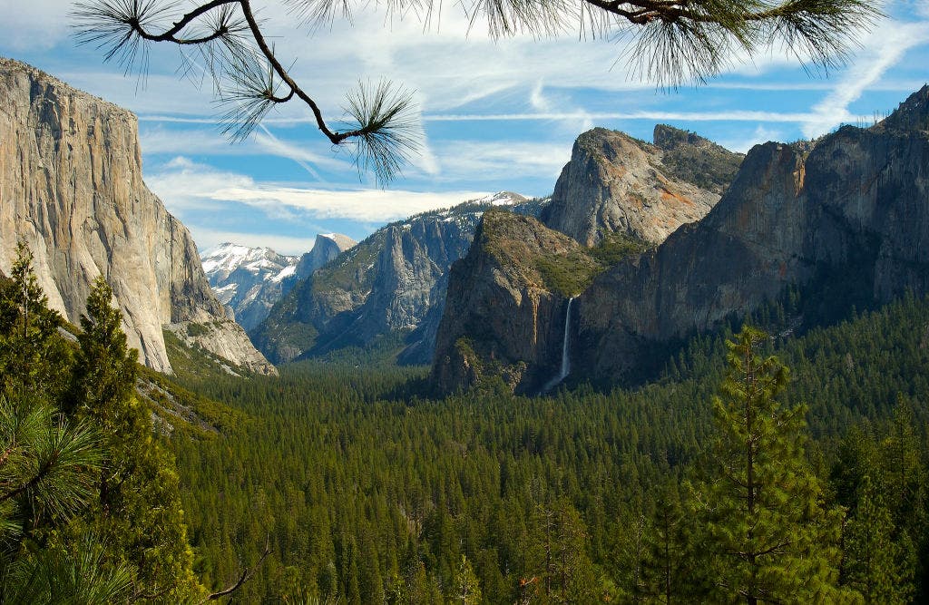
Clouds Rest, Yosemite National Park
If You Missed the Half Dome Permit
What to Know: Tough-to-snag Half Dome may be the most famous hike in Yosemite National Park, but prominent Cloud’s Rest might be the crown jewel. This strenuous out-and-back,12.5-mile day hike kicks off at the Sunrise Lakes Trailhead and gains approximately 3,200 feet, most of them over a mile of brutal switchbacks near the start. But the effort is worth it for panoramic views from one of the highest points in Yosemite Valley. Carve out time to chill on the summit for epic, 360-degree views: you can usually spot Cathedral Rocks, El Capitan, and the electric blue Tenaya Lake. Dappled forests, challenging grades, and an exhilarating final scramble along The Spine, a rocky and narrow route to the summit, will leave you breathless. While you may not be atop Half Dome, squint and you might spot insect-like trekkers on their cable ascent, as you gain a rare look down on the iconic landmark from 1,000 jaw-dropping feet above it.
Important Information: Like so many high-alpine hikes, Cloud’s Rest is best tackled from late June to early October due to snowmelt and access road closures. September brings milder weather, fewer crowds, and less mosquitoes. But be warned: this is a big day hike. The difficult terrain can add unexpected hours to the trail. In the shoulder season, it’s easy to run out of daylight, so bring a headlamp and start at daybreak. Up to half of Cloud’s Rest is exposed and rocky—sunscreen, sturdy footwear, and a hat are musts. High elevation also means severe afternoon thunderstorms are common, so make a flexible weather plan. It’s also smart to carry a filter to purify water from the many creeks along the trail or pack at least two liters for the long haul. You’ll get extra thirsty pounding this trail.
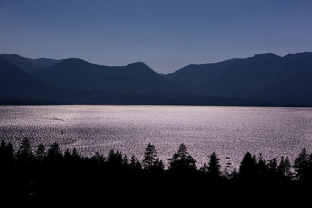
Tahoe Rim Trail, California
If the John Muir Trail Permits Are Sold Out
What to Know: The Tahoe Rim Trail (TRT) is a 167-mile thru-hike in the High Sierra replete with crystal alpine lakes, vast glacial valleys, craggy slopes, and tucked-away meadows speckled with seasonal lupine and flowering sagebrush. You’ll gain just under 30,000 feet of total elevation as you trace a giant loop around the best views of Lake Tahoe, the largest alpine lake in the U.S. Expect black bears, the rare golden eagle, and cobalt Steller’s jays, along with dense stands of red fir and lodgepole pine. Laid-back mountain towns make for quick resupply, and dips in the cold, clear waters of Lake Tahoe are instant refreshers. The well-marked trail is also your ticket to the coveted moonscape of Desolation Wilderness, renowned for huge erratic rocks, dramatic, open ridges, and rolling granite. Spectacular views of Lake Tahoe beckon the entire way.
Important Information: Like many hikes in the High Sierra, the TRT is best tackled July-September. Even so, snow can stick to high peaks and north-facing slopes well into August, so be prepared. In summer, the often-exposed trail can be buggy, dusty, and hot—pack plenty of sunscreen, a head net, and have a reliable water system. As the residential community around Lake Tahoe has grown, bears have been pushed further uphill and become habituated to human food. A bear-proof, failsafe food storage system is essential.
While the TRT does not require a permit, overnight permits for the surrounding Desolation Wilderness must be obtained in advance. Fortunately, beginning March 20, 2026, an exclusive thru-trekker overnight use quota zone became available on Recreation.gov under Zone 46: Tahoe Rim Trail. Be sure to camp within 300 feet of the TRT corridor with this permit and avoid Lake Aloha. Dispersed camping is otherwise allowed all along this route. Hikers must also have a valid California Campfire Permit to use a stove on any part of the trail. Snag one for free here.
The Beaten Path and Beartooth Highway, Montana
If Going-to-the-Sun Road Is Too Crowded
What to Know: This bucket-list, 26.3-mile (3,300-foot elevation gain) Montana hike basically closed after a major 2022 flood washed out a critical bridge above the swollen East Rosebud Creek. The bridge is back up in 2026 thanks to rangers at Beartooth Ranger District and the Custer Gallatin National Forest—and the rugged Beaten Path is once again open.
This point-to-point trek slices through the Beartooth-Abroska Wilderness, the largest unbroken swath of alpine wilderness above 10,000 feet elevation outside Alaska. A moderately strenuous trail passes tumbling cascades, lazy creeks, boulder-strewn meadows, and cerulean lakes pinpricked across the landscape. Here, you might spot grizzly bears and moose among an explosive rainbow of seasonal blooms. Much like Glacier, this hike also invites you to drive an unrivaled highway—Beartooth Highway, a 68-mile road that connects the towns of Red Lodge and Yellowstone. The Beaten Path rarely lets up on vistas of austere, snow-dusted granite and pristine forests. You’ll feel dwarfed by the sheer scale of it all—and understand that Glacier is far from all Montana has to offer.
Important Information: This trail stuns in either direction, but beginning at Clark Forks cuts elevation gain by nearly 2,000 feet. This is a point-to-point hike with no shuttle. The trailhead (East Rosebud Trail) and terminus (Clark Forks) are about three hours apart—some hikers drop a car at each point, though key swaps are also reliable on this one. This hike is best attempted mid-July through September. However, the Beartooth Range tends to have the highest snowfall of any in Montana, so aim for later in the season if you can swing it. Warm gear is a boon on this trail in case of storms or unexpected precipitation, and pack a microfiber towel–you’ll want to plunge into the multiple glimmering lakes. For anglers, expect ample chances to hook trout. And don’t forget to rent or purchase bear spray in Red Lodge, Cooke City, or nearby Yellowstone.
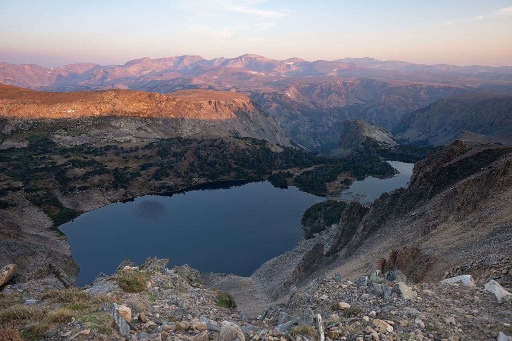
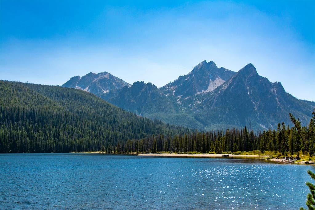
Washakie Pass Loop, Wyoming
If You Missed the Teton Crest Trail’s Deadline
What to Know: Known as “The Winds” by those that love them, ages of tectonic and glacial activity chiseled out unique stone basins and amphitheaters in the Wind River Range, including the horseshoe-shaped, many-spired Cirque of the Towers—15 peaks that stretch above 12,000 feet in elevation to hug the Continental Divide. Located about 70 miles from the famed Teton Crest Trail, the Washakie Pass Loop covers 36.5 untamed miles over 6,650 feet of tough elevation gain. At the highest point—tundra-draped Lizard Head Plateau—expect generous wraparound views, and pause along the trail for plenty of chances to witness the Cirque framed in placid alpine lakes. Deep meadows lush with vibrant prairie bluebells, gushing water, and resplendent valleys snuggled between giant, slate grey walls top off this classic adventure.
Important Information: Like so many Rocky Mountain hikes, this one is best done July-September, though expect snow to hang out into late summer. Watch out for fast-moving afternoon thunderstorms in July and August, and before mid-August, bring gear to deter mosquitoes and biting flies. September ushers in an evening chill, but also illuminated, russet meadows that are so gorgeous you may briefly forget about the cold. Most people hike the trail clockwise for both navigation (a GPS and map are helpful), elevation gain, and to save the sculpted Cirque of the Towers for last. If you’re flexible and game for a climb, you can also add a 12-mile round-trip spur to popular Texas Pass. Bring ankle-supporting boots for ascents up leg-busting, scree-covered grades. Bear spray is also a must.
Also, prepare to navigate 27 miles of bumpy, at times muddy dirt roads to the trailhead. While generally possible with a two-wheel-drive car, a high-clearance vehicle—and a full tank in case things go haywire—doesn’t hurt. Expect large crowds and limited parking at the Big Sandy Trailhead, so arrive early. Pinedale, a small town just 1.5 hours away, offers ample night-before accommodations for a dawn start.
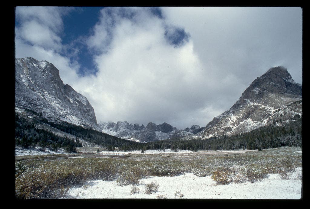
Alice Lake-Toxaway Loop, Idaho
If You Couldn’t Get the Enchantments Traverse
What to Know: The Sawtooths are a generally well-kept, beloved backpacker secret, and the 18.8-mile Alice-Toxaway Loop will show you why. This heady trail meanders through serene forest and scrambles up 3,130 feet of grand alpine passes into the heart of the 217,088-acre Sawtooth Wilderness. Namesake jagged peaks are so gray they seem washed with soft lavender—and around each corner, countless turquoise lakes shimmer in welcome. Like the Enchantments, the trail snakes past world-class water features, from creeks stocked with fish, to burbling streams and narrow, tucked-away waterfalls that trickle down exposed rock into yawning, emerald valleys. Plenty of flat, sun-baked slabs beg you to plunk down and nap near Toxaway Lake. Twin Lakes also stand out, huddled in their alpine embrace and flanked by proud granite slopes. And nothing compares to waking up beside Alice Lake, where sunrise casts the 9,899-foot El Capitan in pale honey light—an image almost perfectly mirrored in gently lapping water below. With few crowds and plenty of solitude, the Sawtooths linger nearby.
Important Information: Just three hours from Boise, expect plenty of parking at the Tin Cup-Petit Lake trailhead and ample dispersed night-before camping. While the well-maintained loop can be completed in either direction, hiking counterclockwise reduces long downhill switchbacks and maximizes views. Add a quick spur to the small Edith Lake if you can (a three-mile, 1,000-foot gain walk) for a moment of peace. Daytime temperatures are pleasant here during peak season, but bring warm gear for night, as it can dip below freezing, even in summer. Bear cans are a must, as are sturdy shoes with solid treads and waterproof footwear to cross creeks. Prepare to hunt for campsites at busy Alice Lake, though hanging a right at the trail junction leads to fine under-the-radar impacted spots. Dogs are allowed on this one while leashed.
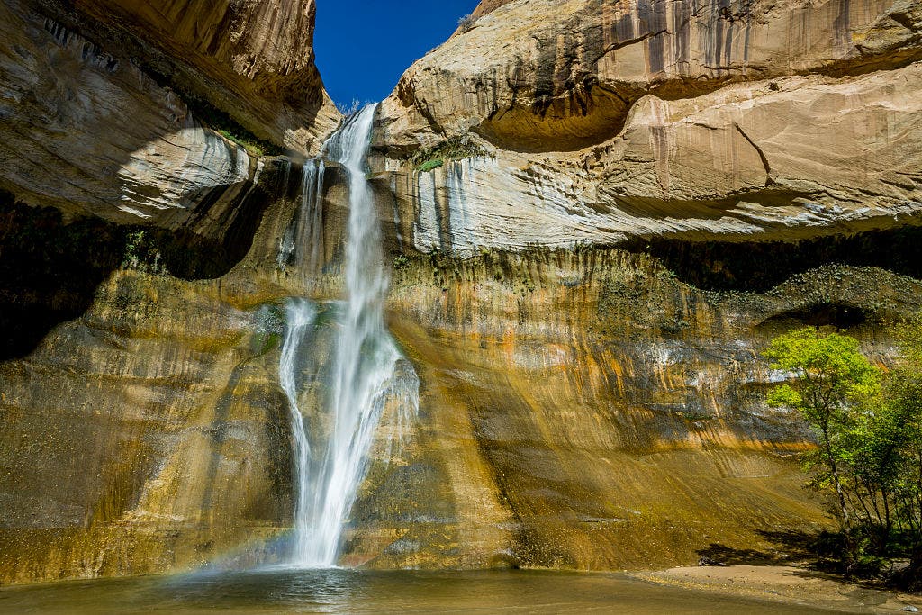
Coyote Gulch Loop, Grand Staircase Escalante National Monument
If the Grand Canyon Rim-to-Rim Is Closed
What to Know: The 10.6-mile Coyote Gulch Loop Trail invites you to play. A thrilling slot canyon traverses funky geological features and towering maroon, Navajo sandstone buttes, gaining 1,643 feet. You’ll hunt for ancient petroglyphs, gape at deep rock alcoves, and gawk at year-round waterfalls. Hanging gardens and streams lined by chartreuse cottonwoods and swaying willows poke through a vivid palette of orange and black-streaked stone. Arches and natural bridges sweep like buttresses from jumbles of rock, giving this landscape a mystical, cathedral-like quality. And while not nearly as long or strenuous as the Grand Canyon, this hike packs nearly as much adrenaline through route-finding, scrambles, and boulder-hopping. After a long day in the sun, you’ll be glad to rest near the echoing Jacob Hamblin Arch, and awake to the blaze of celestial light that streams through this hole in the world.
Important Information: While short, this is a physical, exposed hike in an intense desert ecosystem, that is best tackled March-June or September-October for mild temperatures. Plan gear in advance and keep a close eye on the weather, as rainstorms usher in unbearable mud and dangerous flash flooding. You’ll want a cord to lower backpacks through the 100-foot-long, aptly named Crack-in-the-Wall as you shimmy yourself down. Expect plenty of free climbing, slickrock, and stretches of slow-going sand. You’ll also spend much of this hike wading through ankle-deep water (which can be filtered easily for drinking), so pack waterproof shoes. Trails are not well-signed, and GPS or a map is essential. A WAG Bag (purchase one at the Visitor’s Center) and a no-quota safety permit (which you can snag at Escalante Ranger’s Station) are also required.
This hike leaves from unpaved Fortymile Ridge Road, which ends in two miles of dense sand accessible only by four-wheel drive. Camp at the trailhead and start early to beat the stifling desert heat, and be rewarded with shafts of ethereal light dancing on the cliffs.
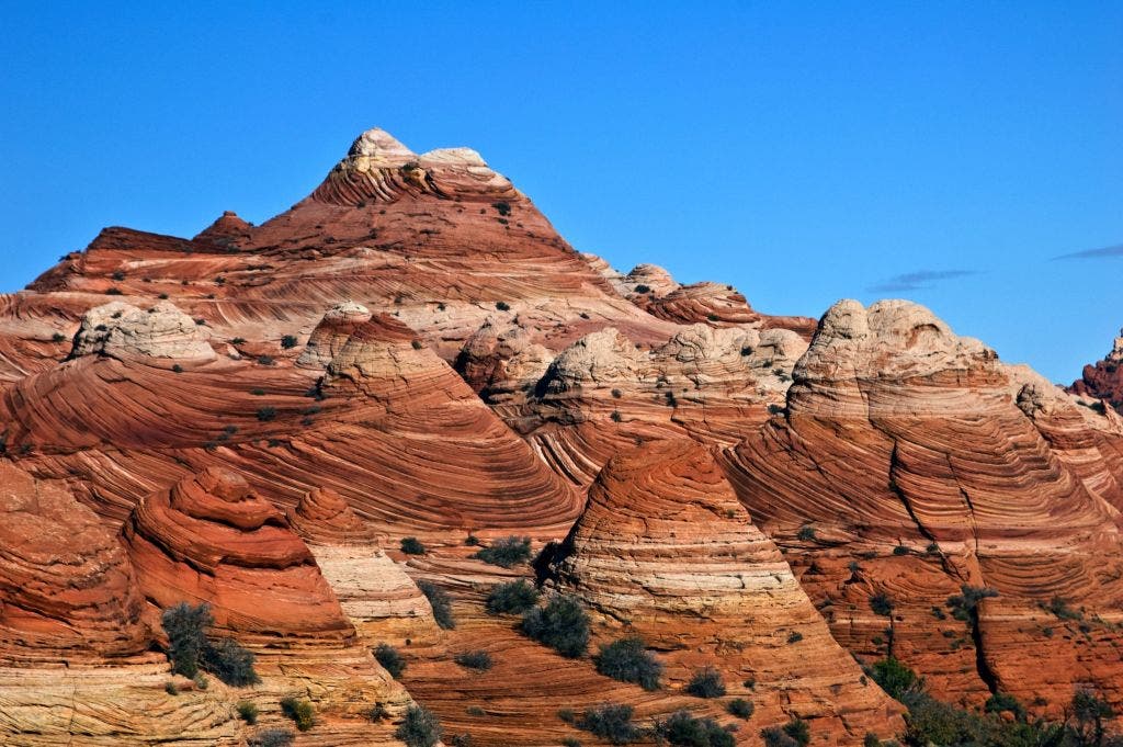
Buckskin Overlook via Wire Pass Trail, Utah
If The Wave Permits Are Sold Out
What to Know: The serpentine Buckskin Gulch is one of the longest continuous slot canyons in the world. The Wire Pass Trail reveals subterranean secrets over a 5.7-mile, relatively flat out-and-back journey. Expect boulders wedged between undulating 200-foot-high red sandstone walls, loose sand, and tricky obstacles to maneuver. The looming canyon nearly obscures sunlight, and sinuous, layered stone reveals warm burgundy, grey, and violet striations smoothed by centuries of flooding. This adventure is all about squeeze and compression: it demands you scramble, scale ladders, and wade (sometimes up to chin deep) in mucky, frigid standing water, all while navigating a slot rarely greater than 10 feet wide. Yet Buckskin also urges the mind to wander as you navigate it, humbled by the force and rhythm of nature.
Important Information: As with most hiking in the region, this trek requires a safety permit ($6 per person and per-dog at Recreation.gov). Unlike The Wave, there’s no day-use quota. This trail is best hiked March-June or September-October, outside of summer heat and monsoon season. Flash flooding can occur at any time, especially between June and August. Check the weather closely beforehand, any rain within 40 miles could trigger an emergency. Also, bring waterproof shoes and quick-dry clothing to tackle the many wet obstacles inside the canyon. Speaking of water, pre-fill your bottle (there is no water at the trailhead) and carry more than you need. There’s nowhere to filter once inside. A WAG Bag is required for all human waste, and a First Aid Kit is wise. Not only is this location remote and hard to reach, but curled rattlesnakes and tarantulas lurk in nooks. Know how to react if you see these venomous creatures. Finally, unpaved House Rock Valley Road drops you at the Wire Pass Trailhead. Go slowly in a standard car or get your hands on a four-wheeled-drive vehicle for this jerky ride.
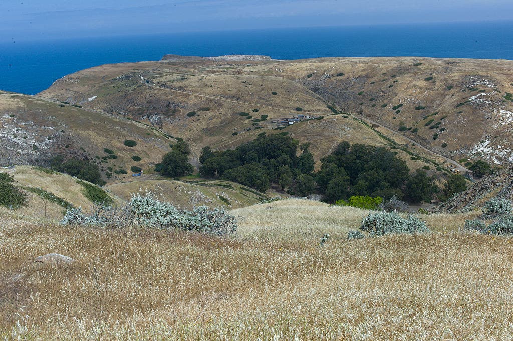
Santa Cruz Island, Channel Islands National Park
If the Kalalau Trail Is a Little Too Far Away
What to Know: The Channel Islands comprise eight Pacific islands off the coast of Ventura, California. They are often called the “Galapagos of North America,” and for good reason. There are olive-hued scrub and sage that seemingly melt off white bluffs into the raucous ocean below, fields pinpricked with cheerful yellow giant coreopsis, and tender sunsets that tinge the mountaintops rose, it’s a biodiverse coastal landscape to cherish. This 12.8-mile overnight trek climbs 2,677 feet on an exposed, moderately maintained, and brushy trail (pack long pants). The top, a scrambly Montañon Ridge, offers a dreamy open walk with awesome wide-angle views. You’ll also hike through canyons and oak groves, on a historic ranch road, and will have the chance to check out the cove at picturesque Potato Harbor—a quick detour, but a highlight. By day, look out for dolphins on the horizon, sweet island foxes, and white-trumpeted island morning glory flowers. By night, enjoy the wavy shoreline and ochre limestone bluffs from your campsite. As you fall asleep to yelping sea lions and soothing waves, you’ll be glad you stayed a while.
Important Information: There are three key things to plan for when trekking Santa Cruz: water, campsites, and transportation. Most people start at Prisoners Harbor and hike to Scorpion Anchorage, but the ferry from the mainland usually drops people at Scorpion Anchorage. To arrange a split drop off/pickup, call Island Packers instead of booking online. Be sure to book ahead and give yourself a cushion to boat in, hike, and boat out (also consider: windy or stormy weather may impact ferry departures). There are only two campgrounds on this hike: Del Norte (three miles in, with four primitive sites) and Lower Scorpion Canyon (terminus, with 25 sites). This makes for a long second day, especially because you’ll need to carry all your water. There’s no guaranteed potable water on the island, except for a tap at Scorpion Anchorage. Book a camp ahead here for $15 a night, and note that dispersed camping is not allowed. This adventure is superb in winter or spring when the island is brilliant green; it can become brown and crunchy in summer. Plan for dense fog, heavy dew on grassy, sock-soaking paths, and take it easy on eroded descents. A hat, sunscreen, and polarized sunglasses are clutch for beating the sun and minimal shade.
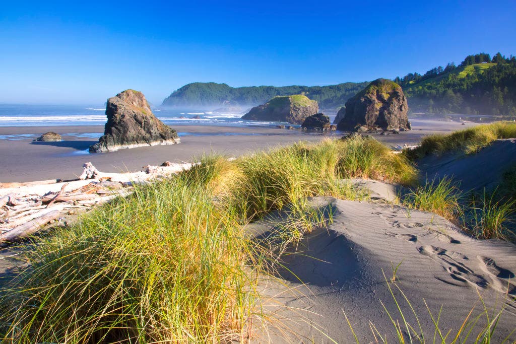
The Oregon Coast Trail, Oregon
If You Missed a Chance to Hike the Lost Coast Trail
What to Know: Playful sea lions, distant whales, and pelicans are common on this 31.5-mile section of the Oregon Coast Trail— a 400-mile thru-hike winding between temperate, mossy rainforest and endless Pacific Northwest shoreline. Fellow hikers, not so much. All the better for a secluded adventure along misty beaches peppered with sea stacks and giant kelp. This adventure demands respect for the tides. Packed wet sand at low tide helps with walking, and you’ll need to cross three rivers that surge at high tide. But the tangy, clean scent of sea spray and radiant purple-pink twilights make the planning more than worth it. You’ll awe at hemlocks, and Sitka spruce trees clinging to 100-foot-tall coastal bluffs, waves tumbling polished, bone-white driftwood, and a hazy marine layer that blankets the sea in thick, spongy fog. Bring binoculars for birdwatching and wildlife, and be sure to admire the historic lighthouse as you approach the dramatic Cape Blanco headland.
Important Information: Most people hike this trail southbound to keep the howling coastal winds behind them. At the end of the road, some people hitch a ride up Highway 101 back to their car. You can also drop a car at each point. It’s also possible to hop on the Coastal Express bus (weekdays only), which has reduced hours due to federal funding cuts. This hike is best from June through September for the less likelihood of heavy rain, which keeps rivers low and safer to cross. But prepare to get wet regardless. You will be glad to have waterproof footwear, a raincoat, and warm layers in case of strong gusts or spotty coastal showers. Most of this trek is on the beach. Keep a tide map handy and always be sure you check tides and storm swells before setting up camp. Also expect to plan campsites in advance on this one, you’ll need to avoid wildlife management areas (the protected Snowy Plover nests in dunes March 15- September 15) and some designated campsites are far apart. Check online for the latest. Fires are usually OK but with strict rules governing them, but dogs are not allowed on the trail during breeding season.